Category:Maps of the Hussite Wars
Jump to navigation
Jump to search
Media in category "Maps of the Hussite Wars"
The following 10 files are in this category, out of 10 total.
-
 Bitva pod Vyšehradem (situace před bitvou).png 1,274 × 1,720; 3.4 MB
-
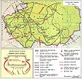
 Kingdom of Bohemia during the Hussite Wars.jpg 1,151 × 861; 468 KB
-
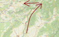 Mapy.cz - turistická - bitva u Ilavy a Bánova.png 972 × 614; 1.18 MB
-
 Mitteleuropa BV042512226.jpg 2,649 × 1,858; 867 KB
-
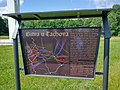
 Sudoměř-detail infotabule.jpg 1,536 × 2,048; 284 KB
-
 The Bohemian Realm during the Hussite Wars.png 3,187 × 2,456; 1.79 MB
-
 The Hussite wars, by the Count Lützow - map.jpg 3,203 × 2,559; 2.42 MB
-
 Vysoká (Tachov) in 2021 (2).jpg 4,608 × 3,456; 2.36 MB
-
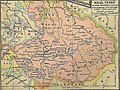
 Země Koruny české za husitských válek.png 990 × 765; 398 KB
-
 Гуситские войны.jpg 1,054 × 1,014; 263 KB
.png)


_in_2021_(2).jpg)

