Category:Maps of the Han Dynasty
Jump to navigation
Jump to search
- 中文:漢朝地圖的媒體集。
Subcategories
This category has the following 2 subcategories, out of 2 total.
- Maps of the Western Han Dynasty (32 F)
M
- Maps of the Eastern Han Dynasty (20 F)
Media in category "Maps of the Han Dynasty"
The following 63 files are in this category, out of 63 total.
-
 China - Començament dau sègle I.png 1,007 × 603; 93 KB
-
 Dang Buyo.png 2,880 × 2,094; 111 KB
-
 Flag-map of Han Dynasty.png 549 × 341; 25 KB
-
 Four Commanderies of Han.jpg 2,436 × 2,888; 500 KB
-
 GreatWallOfHanDynasty blank.png 524 × 227; 238 KB
-
 GreatWallOfHanDynasty HE.png 524 × 227; 248 KB
-
 GreatWallOfHanDynasty-2010-14-07.png 524 × 227; 260 KB
-
 GreatWallOfHanDynasty.png 524 × 227; 244 KB
-
 Han Dynasty Plain.PNG 1,427 × 628; 61 KB
-
 Han dynasty population distribution in 2 AD.jpg 4,505 × 4,516; 1.92 MB
-
 Han Dynasty with protectorate and other areas.PNG 1,427 × 628; 61 KB
-
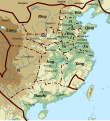
 Han Dynasty.jpg 959 × 1,363; 1.32 MB
-
 Han Empire.jpg 656 × 417; 69 KB
-
 Han expansion.jpg 862 × 887; 411 KB
-
 Han map.jpg 850 × 550; 151 KB
-
 Han occidentaux 195 aC.svg 920 × 1,006; 507 KB
-
 Han orientaux 140.svg 920 × 1,006; 525 KB
-
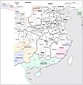
 Han provinces-zh-classical.png 555 × 545; 525 KB
-
 Han provinces.jpg 555 × 545; 262 KB
-
 Han2.jpg 403 × 206; 41 KB
-
 Hanbanchaochushixiyukoko.gif 902 × 286; 44 KB
-
 Houana Khouana.png 2,880 × 2,094; 128 KB
-
 Hyondo-rom.png 736 × 1,114; 923 KB
-
 Jian'an Commanderies.png 2,500 × 1,800; 5.28 MB
-
 Jian'an Commanderies.svg 3,125 × 2,250; 7.37 MB
-
 Magadha han.PNG 1,427 × 628; 48 KB
-
 Manchuria HanDynasty.png 7,360 × 4,751; 20.35 MB
-
 Map of the Han dynasty.svg 750 × 450; 33 KB
-
 Mawangdui Military Map.jpg 2,337 × 2,961; 2.19 MB
-
 Mawangdui Topographic Map.jpg 2,929 × 2,889; 2.37 MB
-
 Periplus World Map.jpg 2,142 × 1,774; 785 KB
-
 Qin Uprisings.png 1,276 × 902; 382 KB
-
 Roman HanEmpires1CE.png 2,214 × 959; 39 KB
-
 Roman HanEmpiresAD1.png 2,214 × 959; 25 KB
-
 RomanandHanEmpiresAD1.png 2,214 × 959; 76 KB
-
 Shao cao 195-200.png 180 × 152; 17 KB
-
 Tao qian.png 245 × 216; 6 KB
-
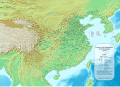
 Topographic 3K Map.jpg 1,633 × 1,549; 2.72 MB
-
 Warlords in 194-ko.jpg 555 × 545; 339 KB
-
 Warlords in 199-ko.jpg 555 × 545; 347 KB
-
 Warlords in 208-ko.jpg 555 × 545; 341 KB
-
 Warlords in 215-ko.jpg 555 × 545; 336 KB
-
 Xin Dynasty Uprisings.png 1,272 × 900; 488 KB
-
 Xin Dynasty.png 1,125 × 795; 390 KB
-
 Yellow Turban Rebellion in china.jpg 2,560 × 1,788; 766 KB
-
 Yellow Turban Rebellion.jpg 1,130 × 790; 133 KB
-
 ZhangQianTravel.jpg 672 × 504; 53 KB
-
 Ταξίδια του Τζαν Τσιάν.jpg 672 × 504; 137 KB
-
 Восстание Желтых повязок.jpg 1,024 × 716; 164 KB
-
 Империя Хань.jpg 1,600 × 913; 206 KB
-
 هان منگ.png 2,880 × 2,094; 111 KB
-
 中国漢四郡Four Commanderies of Han.jpg 2,436 × 2,888; 492 KB
-
 匈奴帝国.png 2,549 × 1,700; 2.06 MB
-
 天汉年间东北亚局势图.jpg 2,436 × 2,888; 1.08 MB
-
 汉初齐地郡国.png 2,213 × 4,576; 1.14 MB
-
 汉手绘图.JPG 1,200 × 1,600; 397 KB
-
 汉朝行政区划(简).png 1,561 × 1,137; 2.01 MB
-
 汉朝行政区划(繁).png 1,657 × 1,137; 2.05 MB
-
 汉武帝时代欧亚大陆形势(简).png 1,103 × 537; 612 KB
-
 汉武帝时代欧亚大陆形势(繁).png 1,103 × 537; 614 KB
-
 漢四郡.jpg 2,436 × 2,888; 613 KB
-
 鮮卑帝国.png 2,549 × 1,700; 2.07 MB
-
 서한군국도.jpg 2,081 × 1,806; 550 KB


.png)
.png)


