Category:Maps of the Gulf of Suez
Jump to navigation
Jump to search
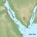
English: Maps of the Gulf of Suez.
Media in category "Maps of the Gulf of Suez"
The following 24 files are in this category, out of 24 total.
-
Admiralty Chart No 3214 Suez Bay, Published 1963.jpg 16,226 × 11,073; 63.73 MB
-
Admiralty Chart No 757 Gulf of Suez, Published 1873.jpg 11,330 × 18,435; 38.72 MB
-
Admiralty Chart No 8a Red Sea Sheet 1, Published 1873.jpg 10,054 × 7,987; 12.86 MB
-
Admiralty Chart No 8a The Red Sea - Sheet I, Published 1873.jpg 20,190 × 16,022; 77.79 MB
-
Admiralty Sheet No 2375 Strait of Gubal, Published 1965.jpg 16,182 × 11,093; 47.57 MB
-
Arabia WDL2921.png 1,396 × 1,024; 2.62 MB
-
Bartlett1879-NorthernGulfSuez.png 557 × 870; 1.39 MB
-
El-Tur Şehir Bölümleri.jpg 776 × 596; 34 KB
-
Gulf of Suez map DE.png 1,280 × 1,280; 1.88 MB
-
Gulf of Suez map mk.svg 1,280 × 1,280; 285 KB
-
Gulf of Suez map-ar.jpg 1,280 × 1,280; 345 KB
-
Gulf of Suez map.gif 539 × 540; 26 KB
-
Gulf of Suez map.jpg 1,280 × 1,280; 348 KB
-
Naval warfare suez gulf 73 war.jpg 600 × 600; 70 KB
-
RouteOfAgyosDemetrios.png 945 × 677; 1.25 MB
-
Shadwan Isle Be.png 647 × 361; 28 KB
-
Sharm el Sheikh map OSM.png 1,673 × 1,427; 234 KB
-
Sinai Peninsula - Suez - War Office - btv1b10104302b.jpg 13,044 × 15,169; 35.44 MB
-
Sinai-peninsula-map-ar.jpg 941 × 1,168; 624 KB
-
Sinai-peninsula-map.jpg 941 × 1,168; 665 KB
-
Suessi laht.png 1,280 × 1,280; 1.68 MB
-
Suez Bay, Egypt (Justus Perthes' Geographische Anstalt, 1856).jpg 1,510 × 1,278; 386 KB
-
Suez1856.jpg 1,449 × 1,242; 342 KB


