Category:Maps of the Gulf of Corinth
Jump to navigation
Jump to search
Media in category "Maps of the Gulf of Corinth"
The following 17 files are in this category, out of 17 total.
-

-
 Admiralty Chart No 1600 Akra Psaromita to Akra Ay Theodoroi, Published 1955.jpg 16,382 × 11,257; 34.18 MB
-
 Admiralty Chart No 1676 Akra Killini to Akra Saromita, Published 1954.jpg 16,190 × 11,067; 44.76 MB
-
-
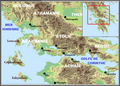
 Gulf of Corinth Fault Map.jpg 755 × 320; 39 KB
-
 Gulf of Corinth.png 200 × 204; 16 KB
-
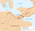 Isthmus of Corinth-ar.svg 672 × 600; 144 KB
-
 Isthmus of Corinth-es.svg 672 × 600; 250 KB
-
 Isthmus of Corinth.svg 672 × 600; 117 KB
-

-
 Le golfe de corinthe.png 630 × 454; 361 KB
-
 Lepanto (BM 1898,0725.8.1101).jpg 1,398 × 901; 399 KB
-
 Llac copais despres segle XIX.jpg 1,518 × 543; 804 KB
-
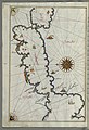
 Map of the gulfs of Corinth and Patras - Camocio Giovanni Francesco - 1574.jpg 1,500 × 1,111; 984 KB
-
 Morea Pars - Dapper Olfert - 1688.jpg 1,500 × 1,243; 1.02 MB
-
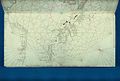
 Piri Reis - Map of Saronikos Bay - Walters W658133A - Full Page.jpg 1,228 × 1,800; 2.8 MB
-
 Series 1404 sheet 343-B Patrai, published 1959.jpg 6,902 × 5,923; 14.42 MB


.jpg)


.jpg)