Category:Maps of the Gulf Islands
Jump to navigation
Jump to search
Media in category "Maps of the Gulf Islands"
The following 19 files are in this category, out of 19 total.
-
 Gulf Islands map 2 without border.png 801 × 871; 582 KB
-
 Gulf Islands map 2.png 801 × 871; 594 KB
-
 Vancouver Gulf Köppen.svg 810 × 905; 577 KB
-
 24 Capital Regional District British Columbia.svg 1,035 × 770; 14.66 MB
-
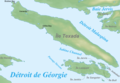 Carte ile Texada.png 1,009 × 695; 317 KB
-
 Carte simplifiée ile Gabriola.svg 1,662 × 921; 64 KB
-
 Earth-BC-SGI-by-bguiled.jpg 576 × 537; 139 KB
-
 Gabriola Island highlighted in Nanaimo.svg 827 × 497; 5.03 MB
-
 Gulf Islands map.png 770 × 669; 288 KB
-
 Hornby Island, BC 19.jpg 4,000 × 3,000; 3.17 MB
-
 Locmap-Texada.png 396 × 256; 36 KB
-
 Locmap-Texada2.png 396 × 256; 42 KB
-
 Mayne island.png 1,138 × 850; 51 KB
-
 Moresby Island (Gulf Island) location.png 600 × 409; 363 KB
-
 Penelakut.png 1,814 × 1,196; 4.06 MB
-
 Shingle Beach Park (9315915255).jpg 1,024 × 768; 143 KB
-
 South gulf islands.png 1,200 × 992; 63 KB
-
 SSI--map-by-bguiled2.jpg 216 × 323; 68 KB
-
 SSI-map-by-bguiled.jpg 288 × 431; 84 KB


_location.png)

.jpg)


