Category:Maps of the Greater Toronto Area
Jump to navigation
Jump to search
Subcategories
This category has only the following subcategory.
N
- Neighbourhood maps of Toronto (161 F)
Media in category "Maps of the Greater Toronto Area"
The following 10 files are in this category, out of 10 total.
-
 Black Canadians in the GTA.svg 647 × 601; 52 KB
-
 Greater Toronto Area map-de.svg 655 × 675; 81 KB
-
 Greater Toronto Area map-es.svg 643 × 500; 263 KB
-
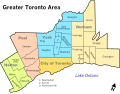 Greater Toronto Area map.svg 643 × 500; 327 KB
-
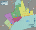
 Greater Toronto.png 1,028 × 1,104; 1.15 MB
-
 GTA regions map.png 2,344 × 1,953; 795 KB
-
 GTA regions map.svg 750 × 625; 2.86 MB
-
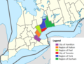 GTHA map.png 672 × 509; 133 KB
-
 Italian Canadian population by Toronto subdivision.svg 647 × 601; 57 KB
-
 YorkCountyOntario1880s.jpg 535 × 720; 244 KB


