Category:Maps of the Great Barrier Reef
Jump to navigation
Jump to search
Media in category "Maps of the Great Barrier Reef"
The following 32 files are in this category, out of 32 total.
-
275px-LocMap of WH Great Barrier Leef.png 275 × 210; 27 KB
-
Admiralty Chart No 1024 Fraser Island to Cumberland Islands, Published 1960.jpg 16,460 × 11,279; 46.59 MB
-
Admiralty Chart No 2354 Cape Grenville to Booby Island, Published 1855, New Edition 1915.jpg 19,382 × 10,896; 55.46 MB
-
Admiralty Chart No 2763 Australia, Coral Sea and Great Barrier Reefs. Sheet 1, Published 1860.jpg 11,888 × 7,771; 47.94 MB
-
Admiralty Chart No 2763 Coral Sea and Great Barrier Reefs Australia Sheet 1, Published 1860.jpg 21,417 × 11,138; 62.16 MB
-
Admiralty Chart No 2764 Australia, Coral Sea and Great Barrier Reefs Sheet 2, Published 1860.jpg 11,840 × 7,898; 44.87 MB
-
Admiralty Chart No 2920 Cape Direction to Cape Grenville, Published 1897.jpg 10,865 × 16,159; 58.06 MB
-
Admiralty Chart No 2921 Claremont Point to Cape Direction, Published 1899.jpg 14,627 × 16,185; 69.49 MB
-
Admiralty Chart No 2922 Turtle Group to Claremont Point, Published 1891.jpg 20,779 × 10,908; 71.67 MB
-
Admiralty Chart No 347 Percy Isles to Whitsunday Passage, Published 1965.jpg 11,256 × 16,436; 55.98 MB
-
Atoll research bulletin (1981) (20157955228).jpg 2,318 × 3,318; 607 KB
-
Carte d'une Partie de la Côte de la Nle. Galles Meridle. (18951780623).jpg 5,112 × 4,264; 3.14 MB
-
Cato Reef.jpg 3,428 × 1,845; 223 KB
-
FMIB 43978 Great Barrier Reef and the Straits of Torres.jpeg 1,041 × 1,653; 392 KB
-
Frederick Reef Chart1.jpg 693 × 1,172; 111 KB
-
GBReef TempChlorophyll 200602.jpg 540 × 779; 83 KB
-
Great Barrier Reef Marine Park locator map.svg 2,055 × 1,846; 347 KB
-
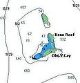
Kenn reef.jpg 211 × 219; 9 KB
-
Map of Great Barrier Reef Demis.png 945 × 1,058; 200 KB
-
Map of The Great Barrier Reef Region, World Heritage Area and Marine Park, 2014.tif 1,379 × 2,021; 3.21 MB
-
The Great Barrier Reef of Australia (Plate) (6898578584).jpg 1,398 × 2,009; 2.16 MB


