Category:Maps of the Golan Heights
Jump to navigation
Jump to search
| Category Maps of the Golan Heights on sister projects: | |||||||||
|---|---|---|---|---|---|---|---|---|---|
See: Golan Heights.
Subcategories
This category has the following 3 subcategories, out of 3 total.
Media in category "Maps of the Golan Heights"
The following 81 files are in this category, out of 81 total.
-
-South lebanon Qana locator map.png 800 × 595; 299 KB
-
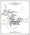
1885 map of the Sea of Galilee and part of the Golan.jpg 3,385 × 3,963; 1.29 MB
-
1949 Israeli-Syrian General Armistice Agreement (png).png 4,227 × 11,591; 1.82 MB
-
1949 Israeli-Syrian General Armistice Agreement.tiff 6,176 × 11,666; 1.28 MB
-
2009 Golan Heights 3D (30849226396).jpg 3,400 × 4,200; 4.58 MB
-
BlueLine ver2.jpg 1,299 × 898; 238 KB
-
BlueLine-ar.jpg 1,024 × 708; 226 KB
-
BlueLine.jpg 1,299 × 898; 157 KB
-
Btishim98.png 811 × 2,168; 830 KB
-
Btishimveshmone.png 1,216 × 3,252; 1.33 MB
-
CIA map of the Israel occupied Golan Heights and vicinity, October 1994 (cropped).png 2,369 × 4,934; 5.82 MB
-
Disdrigoù Israel.png 350 × 969; 148 KB
-
Dystrykty Izraela (PNG).png 648 × 1,694; 142 KB
-
Dystrykty Izraela.svg 389 × 1,016; 58 KB
-
Eastern Jaulan and Western Hauran, 1888.jpg 7,087 × 4,676; 4.41 MB
-
Ein Gev - Al Samra - Al Hamma Demilitarized Zone.png 1,337 × 2,354; 160 KB
-
Ghadschar.png 759 × 591; 286 KB
-
Ghajar highlighted-ar.jpg 742 × 860; 372 KB
-
Ghajar highlighted.JPG 742 × 860; 108 KB
-
Golan 1994.jpg 1,885 × 2,384; 794 KB
-
Golan 92.jpg 1,000 × 1,262; 236 KB
-
Golan Antiquities Museum 06.jpg 480 × 640; 102 KB
-
Golan Heights and vicinity, October 1994.png 1,882 × 2,386; 4.69 MB
-
Golan Heights geography.png 758 × 871; 862 KB
-
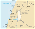
Golan Heights Map He.PNG 415 × 354; 29 KB
-
Golan Heights Map.PNG 415 × 354; 19 KB
-
Golan heights OSM.jpg 1,129 × 1,600; 385 KB
-
Golan Heights proportion map.jpg 974 × 1,231; 239 KB
-
Golan heights rel89-orig.jpg 974 × 1,231; 245 KB
-
Golan heights rel89A (cropped).jpg 722 × 1,308; 302 KB
-
Golan heights rel89A.jpg 1,022 × 1,308; 210 KB
-
Golan heights rel89B.jpg 1,022 × 1,308; 231 KB
-
Golan heights rel89C.jpg 715 × 1,231; 665 KB
-
Golan Heights relief v1.jpg 758 × 871; 273 KB
-
Golan Heights relief v2-ar.png 758 × 871; 1,010 KB
-
Golan Heights relief v2.png 758 × 871; 923 KB
-
Golan location map 2.PNG 936 × 739; 140 KB
-
Golan location map 3.PNG 925 × 739; 146 KB
-
Golan location map.PNG 732 × 628; 76 KB
-
Golan map.png 1,473 × 1,878; 106 KB
-
GolanBorders.svg 534 × 855; 414 KB
-
GolanBordersEN.svg 534 × 855; 75 KB
-
GolanBordersHE.svg 534 × 855; 73 KB
-
GolanHights-UNDOF.jpg 974 × 1,196; 246 KB
-
GolanHights.JPG 980 × 1,282; 240 KB
-
Golanhöhen-Wirtschaft.png 355 × 1,017; 83 KB
-
Golanhøyden.PNG 415 × 354; 27 KB
-
Golanmap.jpg 410 × 599; 66 KB
-
Gottlieb Schumacher. Karte des Ostjordanlandes Blatt I. 1900.jpg 1,024 × 1,200; 249 KB
-
GreenLine1967-1969.png 1,818 × 2,978; 2.14 MB
-
Guvta Stream outline he.svg 640 × 480; 63 KB
-
Huleh Demilitarized Zone.png 1,106 × 3,441; 195 KB
-
ISR-HW98small.jpg 633 × 1,107; 174 KB
-
ISR-HW98small.png 556 × 308; 13 KB
-
Israel Bezirke.png 350 × 969; 41 KB
-
Israel districts.png 350 × 969; 59 KB
-
Israel Map by The Legal Status of The Territories-2.svg 800 × 400; 869 KB
-
Israel Map by The Legal Status of The Territories.svg 271 × 640; 852 KB
-
Israel outline northeast-ar.png 732 × 628; 99 KB
-
Israel outline northeast.png 732 × 628; 110 KB
-
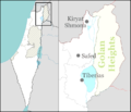
Israel outline northern Safed.png 732 × 628; 37 KB
-
Israel with occupied territories.gif 254 × 607; 9 KB
-
Karte des Ostjordanlandes.jpg 22,772 × 20,864; 364.37 MB
-
Location of Bethsaida map.png 1,118 × 729; 92 KB
-
Majdal Shams attack, July 2024, VI.jpeg 1,600 × 900; 162 KB
-
Majdal.png 974 × 1,231; 2.15 MB
-
OilLine.png 691 × 1,119; 421 KB
-
Palestine and Levant grids.png 500 × 400; 91 KB
-
PikiWiki Israel 44189 BAIT TZIDA.JPG 3,456 × 2,304; 3.88 MB
-
Qanaabé - surveyed, drawn and reproduced by 517 Corps Field Survey Coy. R.E. - btv1b10104269k.jpg 11,310 × 14,358; 20.72 MB
-
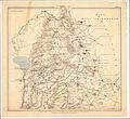
Schumacher's map of the Golan.jpg 3,495 × 5,008; 1.87 MB
-
Shebaa Farms Sketch Map 1937.png 2,420 × 1,894; 958 KB
-
Shebaa Farms-ar.jpg 800 × 1,220; 337 KB
-
Shebaa Farms.jpg 800 × 1,220; 169 KB
-
Syrie revendications.png 328 × 352; 14 KB
-
TelFaher Tablet1.jpg 1,500 × 470; 153 KB
-
UNDOF map june 2011.jpg 2,704 × 3,528; 1.68 MB
-
WV Golan Heights region in Israel.png 613 × 1,140; 82 KB
-
מפה של קו תילי הגעש.png 470 × 643; 17 KB
-
מפת המובלעת הסורית.png 956 × 523; 659 KB
-
שלט חטיבת הזקן במלחמת ששת הימים.jpg 1,024 × 765; 143 KB


