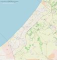
Category:Maps of the Gaza Strip
Jump to navigation
Jump to search
Wikimedia category | |||||
| Upload media | |||||
| Instance of | |||||
|---|---|---|---|---|---|
| |||||
Maps of the Gaza Strip.
Gaza Strip | ||
|---|---|---|
| ||
|
Subcategories
This category has the following 9 subcategories, out of 9 total.
Media in category "Maps of the Gaza Strip"
The following 78 files are in this category, out of 78 total.
-
20180410 Palestine Gaza Crisis April18 LAST.pdf 1,754 × 1,239; 525 KB
-
20180410 Palestine Gaza Crisis April18 LAST.png 1,123 × 794; 1.12 MB
-
2023 Israel–Hamas war green.svg 3,763 × 3,258; 8.24 MB
-
Central north, Gaza strip may 2005 (cropped).jpg 895 × 715; 215 KB
-
Central south, Gaza strip may 2005 (cropped).jpg 928 × 741; 210 KB
-
Cropped Image Gaza Strip 1999.jpg 512 × 478; 36 KB
-
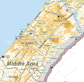
Deir al-Balah (central) OpenStreetMap 2024-01-29.png 2,432 × 1,754; 2.29 MB
-
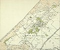
Deir el Balah 1930.jpg 3,002 × 2,539; 2.36 MB
-
Deyr el-balah.PNG 563 × 600; 53 KB
-
Disengagement plan map.svg 512 × 555; 79 KB
-
Gaza 2008 conflict map Arabic.png 1,364 × 875; 247 KB
-
Gaza closure December 2012-crop.jpg 3,107 × 6,952; 2.76 MB
-
Gaza conflict map Arabic.png 1,272 × 621; 325 KB
-
Gaza conflict map Rockets.png 1,365 × 878; 398 KB
-
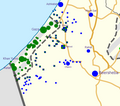
Gaza conflict map.png 612 × 300; 27 KB
-
Gaza conflict map2.png 595 × 365; 108 KB
-
Gaza District Before 1948.png 322 × 598; 35 KB
-
Gaza Strip 1999.jpg 1,438 × 1,960; 364 KB
-
Gaza Strip Access Restrictions.pdf 4,950 × 7,085; 4.76 MB
-
Gaza Strip Arab nation Palestine1957.jpg 242 × 376; 62 KB
-
Gaza Strip map.png 984 × 1,200; 343 KB
-
Flag map of Gaza Strip (Palestine).png 1,861 × 3,625; 57 KB
-
Gaza Strip. LOC 2005631037.jpg 7,992 × 8,556; 10.1 MB
-
Gaza Strip. LOC 2005634007.jpg 2,535 × 3,284; 597 KB
-
Gaza-diseng.JPG 721 × 864; 84 KB
-
Gaza-quarters-he.png 598 × 574; 232 KB
-
GazaMapWithWithdrawal.png 1,026 × 714; 254 KB
-
Gazaseablocade.png 890 × 1,067; 132 KB
-
Gazastreifen Raketenreichweiten.png 1,200 × 2,019; 546 KB
-
Gazastrip Map Middle Area Deir al-Balah.png 1,525 × 1,489; 2.1 MB
-
GazaStripGovernates-NonLabeled.png 222 × 420; 9 KB
-
GazaStripOct2023Vertical.png 883 × 2,812; 3.47 MB
-
Gazeko zerrenda-eu.svg 674 × 827; 491 KB
-
Hamama.png 579 × 457; 171 KB
-
Israel settlements in the Gaza Strip, September 1984. LOC 2011586063.jpg 3,322 × 4,332; 1.34 MB
-
Israel-war-Oct-8-2023.png 528 × 468; 61 KB
-
Karte Gazastreifen Aug 2011.png 986 × 1,202; 343 KB
-
Karte Gazastreifen Dez 2012.png 987 × 1,203; 350 KB
-
Karte Gazastreifen.png 984 × 1,200; 347 KB
-
Khan Younes Map.png 1,049 × 798; 558 KB
-
Location Ghaza.png 600 × 639; 38 KB
-
Location map Gaza.png 921 × 975; 589 KB
-
Location map Palestine Gaza Strip.png 2,358 × 2,976; 1.68 MB
-
Location Rafah.png 600 × 639; 38 KB
-
Map of Gaza Strip with no-go zone 2012.jpg 4,732 × 5,712; 4.93 MB
-
Mapa de la Franja de Gaza.png 575 × 334; 38 KB
-
Netzarim junction map arabic.png 674 × 725; 68 KB
-
Netzarim junction map.png 674 × 725; 82 KB
-
NetzarimCorridor.jpg 1,518 × 1,078; 572 KB
-
North detail, Gaza strip may 2005 (cropped).jpg 726 × 579; 190 KB
-
North gaza insurgency.png 1,606 × 1,109; 338 KB
-
North Gaza July 2018.png 1,683 × 2,381; 1.56 MB
-
Northern Border of Gaza by default.jpg 299 × 252; 61 KB
-
OCHAoPT 2018 Gaza border protests 31 may 2018.png 628 × 491; 71 KB
-
October 2023 Gaza−Israel conflict.svg 3,763 × 3,258; 8.42 MB
-
OpenStreetMap, English rendering of Gaza strip.png 2,732 × 2,884; 2.57 MB
-
Pa gov khan yunis.png 756 × 880; 12 KB
-
Palestine043 (Latuff).png 3,712 × 2,848; 133 KB
-
Palestinian Authority and Gaza Strip 2024.png 703 × 801; 645 KB
-
Rocketpopmap.jpeg 1,366 × 1,045; 392 KB
-
Rockets from gaza (pl).png 1,849 × 3,428; 900 KB
-
Rokets from Gaza eng.png 829 × 1,200; 330 KB
-
Rokets from Gaza rus.png 867 × 1,200; 258 KB
-
Sketch Map of a part of Southern Palestine, 1886.jpg 3,455 × 3,185; 1.45 MB
-
South detail, from- Gaza strip may 2005 (cropped).jpg 1,102 × 875; 318 KB
-
Striscia di Gaza e aeroporto di Ramon.png 450 × 835; 102 KB
-
UNOSAT Gaza Sewage Plant Pre Post Map v12 Highres.png 3,306 × 2,340; 7.23 MB
-
UNOSAT GazaStrip Damage Review 19Feb09 v3 Lowres.png 2,481 × 3,509; 4.54 MB
-
World Factbook (1990) Gaza Strip.jpg 562 × 549; 80 KB
-
WV Gaza Strip region.png 613 × 1,140; 81 KB
-
WV Palestinian territories region.png 613 × 1,140; 81 KB
-
מפת טווחי רקטות מרצועת עזה.jpg 863 × 1,798; 565 KB
-
احياء مدينة غزة.jpg 1,123 × 794; 140 KB
-
الهيكل الاداري لمحافظة غزة.jpg 696 × 683; 45 KB
-
مدن غزة.jpg 1,386 × 1,958; 193 KB


