Category:Maps of the Free City of Danzig (Napoleonic)
Jump to navigation
Jump to search
Polski: Mapy Wolnego Miasta Gdańska czasów Napoleona I Bonapartego
Napoleonic semi-independent city state | |||||
| Upload media | |||||
| Instance of | |||||
|---|---|---|---|---|---|
| Capital | |||||
| Basic form of government | |||||
| Official language | |||||
| Head of state |
| ||||
| Inception |
| ||||
| Dissolved, abolished or demolished date |
| ||||
| Follows | |||||
| Followed by | |||||
| Different from | |||||
 | |||||
- See also: Category:Maps of the Free City of Danzig
Media in category "Maps of the Free City of Danzig (Napoleonic)"
The following 12 files are in this category, out of 12 total.
-
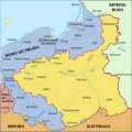
Duchy of Warsaw 1807-1809-es.svg 2,002 × 2,000; 921 KB
-
Duchy of Warsaw 1807-1809.PNG 2,295 × 2,275; 324 KB
-
Duchy of Warsaw 1809-1815.PNG 2,295 × 2,275; 420 KB
-
Duchy of Warsaw and Republic of Danzig.JPG 770 × 724; 187 KB
-
Free City of Danzig (1812).svg 450 × 456; 585 KB
-
Herzogtum Warschau-es.svg 2,002 × 2,000; 499 KB
-
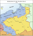
Herzogtum Warschau.svg 554 × 610; 243 KB
-
Herzogtum-Warschau.png 2,303 × 2,539; 1.45 MB
-
N° 72 DANTZIG.jpg 5,443 × 4,021; 5.27 MB
-
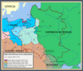
Rzeczpospolitapodrozb.png 700 × 600; 247 KB
-
Siege of Danzig plans of battles-1-.jpg 593 × 464; 228 KB
-
Wmgdansk1807 15.jpg 302 × 450; 136 KB


