Category:Maps of the Eurobahn
Jump to navigation
Jump to search
Media in category "Maps of the Eurobahn"
The following 7 files are in this category, out of 7 total.
-
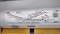
 Aktuelles Streckennetz Eurobahn.png 3,856 × 2,844; 316 KB
-
 Eurobahn 2011.png 4,596 × 1,260; 147 KB
-
 Eurobahn Streckennetz 170311.jpg 3,264 × 1,836; 1.08 MB
-
 Netzkarte-Eurobahn-2012.png 1,200 × 785; 200 KB
-
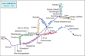
 Netzkarte-Eurobahn-4-2011.png 1,601 × 865; 251 KB
-
 Schwenningdorf Mai 2009 097.jpg 1,600 × 1,200; 553 KB
-
 SPNV NRW eurobahn.svg 4,500 × 3,000; 336 KB


