Category:Maps of the Electorate of Bavaria
Jump to navigation
Jump to search
Subcategories
This category has only the following subcategory.
Media in category "Maps of the Electorate of Bavaria"
The following 4 files are in this category, out of 4 total.
-
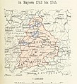
333 of 'Neue Folge' (11186151104).jpg 1,452 × 1,605; 674 KB
-
Bavariae Circulus Et Electorat 1742.jpg 8,704 × 12,288; 18.23 MB
-
Electorate of Bavaria 1789.svg 450 × 456; 928 KB
-
Karte - A new map of Electorate Bavaria - 1794.jpg 2,099 × 2,000; 5.27 MB


