Category:Maps of the Electoral Palatinate
Jump to navigation
Jump to search
Media in category "Maps of the Electoral Palatinate"
The following 21 files are in this category, out of 21 total.
-
Carte Palatinat.png 1,800 × 1,200; 530 KB
-
Geschichtskarte Bayern Kurpfalz.jpg 3,540 × 4,434; 2.54 MB
-
Kurpfalz 1400.png 505 × 506; 218 KB
-
Kurpfalz.PNG 2,814 × 3,841; 929 KB
-
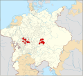
Locator Electoral Palatinate within the Holy Roman Empire (1618).svg 2,769 × 2,524; 1 MB
-
Map of Pfalz-Zweibrücken (1543).svg 686 × 698; 345 KB
-
Map of Pfalz-Zweibrücken (1700)-de.svg 902 × 902; 225 KB
-
Map of Pfalz-Zweibrücken (1700)-hu.svg 902 × 902; 226 KB
-
Map of Pfalz-Zweibrücken (1700)-NL.svg 902 × 902; 225 KB
-
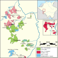
Map of the Electoral Palatinate (1329).svg 865 × 945; 260 KB
-
Map of the Electoral Palatinate (1410)-DE.svg 855 × 1,165; 388 KB
-
Map of the Electoral Palatinate (1410)-es.svg 855 × 1,165; 509 KB
-
Map of the Electoral Palatinate (1410)-NL.svg 855 × 1,165; 388 KB
-
Map of the Electoral Palatinate (1505)-DE.svg 855 × 1,165; 422 KB
-
Map of the Electoral Palatinate (1505)-NL.svg 855 × 1,165; 384 KB
-
Map of the Oberämter of the Electoral Palatinate (1789) - Numbered.svg 3,770 × 2,570; 532 KB
-
Map of the Palatinate in 1410-es.svg 1,457 × 1,681; 1.16 MB
-
Map of the Palatinate in 1410.svg 1,366 × 1,576; 1.06 MB
-
OAN Grenzen und Orte 17982d.png 1,099 × 1,297; 150 KB


