Category:Maps of the Elbe in Germany
Jump to navigation
Jump to search
Subcategories
This category has the following 3 subcategories, out of 3 total.
Media in category "Maps of the Elbe in Germany"
The following 46 files are in this category, out of 46 total.
-
Elbe basin.png 1,309 × 1,381; 1.8 MB
-
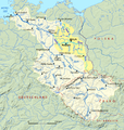
Spree-Havel in Elbe basin.png 1,309 × 1,381; 1.79 MB
-
Elbe Einzugsgebiet.png 1,309 × 1,381; 1.96 MB
-
Map elbe mouth 1910.jpg 1,500 × 927; 787 KB
-
Zimmermann Hasenbanck Elbmündung 1721.jpg 5,523 × 3,357; 17.91 MB
-
Zeekaart van de Noordzee uit 1883.jpg 4,733 × 2,740; 3.61 MB
-
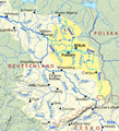
Spree-Havel in Elbe basin, cut.png 787 × 863; 723 KB
-
Dosse.png 721 × 1,046; 30 KB
-
Dresden - 31-51.jpg 3,229 × 4,981; 3.32 MB
-
Bautzen - 32-51.jpg 3,194 × 4,985; 3.51 MB
-
Energiefabrik Knappenrode 2016-05-05 (04).jpg 3,648 × 2,736; 2.13 MB
-
Energiefabrik Knappenrode 2016-05-05 (05).jpg 3,648 × 2,736; 2.11 MB
-
2019 05 18 Lauenburg Elbschiffahrtsarchiv.PNG 1,161 × 553; 132 KB
-
Admiralty Chart No 1875 Jade River to Norder Piep, Published 1934.jpg 16,496 × 11,267; 53.75 MB
-
Admiralty Chart No 3262 North Sea Elbe River Brunsbüttelkoog to Hamburg, Published 1902.jpg 12,188 × 8,337; 16.74 MB
-
Admiralty Chart No 3347 Helgoland Bight and approaches, Published 1919.jpg 11,130 × 16,241; 45.9 MB
-
Brockhaus' Konversations-Lexikon (1892) (14784645355).jpg 2,368 × 1,562; 487 KB
-
Elbflut Medaille 2002 Brandenburg.jpg 1,024 × 2,273; 632 KB
-
Gefälle Elbe Saale.svg 3,500 × 1,550; 14 KB
-
Gefälle ElbeSaale.jpg 3,150 × 1,134; 939 KB
-
Marschbahn alt.jpg 1,886 × 1,026; 1.55 MB
-
Binnenelbe Außenelbe.png 720 × 445; 38 KB
-
Elbmündung Neuwerk.jpg 1,666 × 1,398; 177 KB
-
Natureum Niederelbe 2013 by-RaBoe 027.jpg 1,111 × 738; 834 KB
-
Natureum Niederelbe 2013 by-RaBoe 028.jpg 1,111 × 738; 734 KB
-
Natureum Niederelbe 2013 by-RaBoe 029.jpg 1,111 × 738; 800 KB
-
Natureum Niederelbe 2013 by-RaBoe 030.jpg 1,111 × 738; 783 KB
-
Natureum Niederelbe 2013 by-RaBoe 031.jpg 1,111 × 738; 620 KB
-
Natureum Niederelbe 2013 by-RaBoe 032.jpg 1,111 × 738; 690 KB
-
Natureum Niederelbe 2013 by-RaBoe 033.jpg 1,111 × 738; 859 KB
-
Natureum Niederelbe 2013 by-RaBoe 034.jpg 1,111 × 738; 853 KB
-
Nobilis fluvius Albis - CBT 5874350.jpg 5,715 × 4,451; 6.12 MB
-
Plan des Eisganges der Elbe beÿ Meissen am 24ten Februar 1799.jpg 4,799 × 3,005; 3.57 MB
-
Riesa und Umgebung.jpg 5,717 × 5,036; 12.92 MB
-
Schwarze Elster Fluss Version 9.gif 1,011 × 741; 300 KB
-
Schwarze Elster Flusssystem 1.gif 646 × 537; 159 KB
-
Seekarte Altenbruch.png 779 × 322; 495 KB
-
ElbeBeiWedel1914.jpg 2,293 × 1,316; 2.42 MB
-
Elbe tributaries discharge diagram mk.svg 1,600 × 1,200; 440 KB
-
Elbe tributaries discharge diagram.svg 1,600 × 1,200; 23 KB


