Category:Maps of the Dutch East India Company - Mozambique
Jump to navigation
Jump to search
Media in category "Maps of the Dutch East India Company - Mozambique"
The following 29 files are in this category, out of 29 total.
-
 AMH-2490-NA Post of the company at Rio d'Lagoa.jpg 2,400 × 1,959; 743 KB
-
 AMH-2491-NA Post of the Company at Rio d'Lagoa.jpg 2,400 × 1,798; 570 KB
-
 AMH-2492-NA Company post at Rio d'Lagoa.jpg 2,400 × 1,699; 483 KB
-
 AMH-2493-NA Post of the Company at Rio d'Lagoa.jpg 2,400 × 1,840; 625 KB
-
 AMH-2494-NA Post of the Company at Rio d'Lagoa.jpg 2,400 × 1,878; 708 KB
-
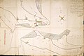
 AMH-2495-NA Plan for a new fort at Rio de la Goa.jpg 2,400 × 1,746; 518 KB
-
 AMH-2496-NA Plan of the old fortification A and the new fort B at Rio de la Goa.jpg 2,400 × 1,672; 584 KB
-
 AMH-2499-NA Plan of the old fort A and the new fort B at Rio de la Goa.jpg 2,400 × 1,742; 522 KB
-
 AMH-2505-NA Map of newly bought lands at Rio de la Goa.jpg 2,400 × 1,625; 543 KB
-
 AMH-2506-NA The Company's trading post at De Lagoa and surrounding lands.jpg 2,400 × 2,112; 859 KB
-
 AMH-2510-NA Map of part of Mozambique.jpg 1,367 × 2,400; 511 KB
-
 AMH-2555-NA Map of the bay of Rio de Lagoa.jpg 2,008 × 2,400; 804 KB
-
 AMH-2556-NA Map of the bay at Rio de Lagoa.jpg 2,400 × 829; 245 KB
-
 AMH-2643-NA Chart of the Lagoa river.jpg 2,400 × 1,000; 320 KB
-
 AMH-5104-NA Map of Lagoa Bay.jpg 1,741 × 2,400; 577 KB
-
 AMH-5105-NA Map of Lagoa Bay.jpg 2,400 × 1,838; 783 KB
-
 AMH-5106-NA Map of Lagoa Bay to Terra di Natal.jpg 2,400 × 1,728; 324 KB
-
 AMH-5336-NA Company post at Rio d'Lagoa.jpg 2,400 × 1,645; 451 KB
-
 AMH-5337-NA Company post at Rio d'Lagoa.jpg 2,400 × 1,715; 536 KB
-
 AMH-5338-NA Plan for a new fort at Rio de la Goa.jpg 2,400 × 1,734; 466 KB
-
 AMH-5339-NA Plan for a new fort at Rio de la Goa.jpg 2,400 × 1,551; 440 KB
-
 AMH-5500-NA Seachart of Mozambique and Madagascar.jpg 2,400 × 1,407; 706 KB
-
 AMH-5603-NA Map of Algoa Bay.jpg 2,400 × 1,864; 845 KB
-
 AMH-5622-NA Map of southern Africa and Madagascar.jpg 2,400 × 1,636; 898 KB
-
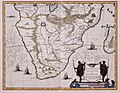 AMH-5653-KB Map of the southern part of the African continent.jpg 2,400 × 1,870; 606 KB
-
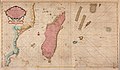
 AMH-6873-KB Map of Madagascar.jpg 2,400 × 1,899; 918 KB
-
 AMH-7428-KB Map of the southwestern part of the Indian Ocean.jpg 2,400 × 1,580; 498 KB
-

-
 AMH-7964-KB Map of part of Mozambique.jpg 2,400 × 2,050; 839 KB


