Category:Maps of the Duchy of Courland and Semigallia
Jump to navigation
Jump to search
Media in category "Maps of the Duchy of Courland and Semigallia"
The following 24 files are in this category, out of 24 total.
-

-
 1706 Livoniæ de Wit- Mortier.jpg 3,000 × 2,494; 4.15 MB
-
 SAPUNOV(1893) -04- p049.jpg 1,797 × 2,751; 2.45 MB
-
 SAPUNOV(1893) -05- p053.jpg 2,385 × 1,529; 1.88 MB
-
 Ambotsche un Neuhausensche Kirchspiele 1770.jpg 293 × 442; 123 KB
-
 Courland in 1702.png 1,847 × 1,181; 3.75 MB
-
 Courland1600.png 1,256 × 768; 38 KB
-
 Courlnd in 1772.svg 1,146 × 1,008; 184 KB
-
 Ducatuum Livoniæ et Curlandiæ Nova Tabula.jpg 4,089 × 3,400; 7.75 MB
-
 Duchy of Courland & Semigallia 1740-es.svg 1,074 × 945; 468 KB
-
 Duchy of Courland & Semigallia 1740.svg 1,074 × 945; 510 KB
-
 Hertogdom Koerland en Semgallen 1740 locator.svg 986 × 1,159; 399 KB
-
 Koerland.jpg 424 × 252; 14 KB
-
 Kurland 1740-hu.svg 1,074 × 945; 259 KB
-
 Kurland Karte.jpg 1,000 × 457; 82 KB
-
 Kurzemes un Zemgales hercogiste 1740 locator.svg 984 × 738; 183 KB
-
 Kurzemes un Zemgales Hercogiste 1740.svg 1,074 × 945; 498 KB
-
 Kurzemes un Zemgales hercogistes karte 1770.jpg 2,882 × 2,263; 5.94 MB
-
 Livland1560-85.gif 1,890 × 1,370; 183 KB
-
 Livland1585-1710.gif 1,890 × 1,370; 168 KB
-
 Map of Courland in 1791 by Reilly 059.jpg 1,290 × 912; 472 KB
-
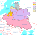 Polish-Lithuanian Commonwealth (1619) compared with today's borders PL.png 3,133 × 2,997; 177 KB
-

-
 Russian Empire 1745 (Map III in Latin).jpg 7,704 × 6,754; 17.16 MB
_compared_with_today%27s_borders_(Russian_version).png)

_-04-_p049.jpg)
_-05-_p053.jpg)


_compared_with_today%27s_borders_PL.png)
_compared_with_today%27s_borders,_Ukrainian_version.png)
.jpg)