Category:Maps of the Drakensberg
Jump to navigation
Jump to search
Media in category "Maps of the Drakensberg"
The following 11 files are in this category, out of 11 total.
-
 AT1003 map.png 1,061 × 844; 15 KB
-
 AT1004 map.png 1,063 × 844; 38 KB
-
 Drakensberg 3D.gif 300 × 214; 7.62 MB
-
 Drakensberg Hydropower.png 1,009 × 753; 216 KB
-
 Drakensberg Pumped Storage.svg 1,052 × 744; 24 KB
-
 Dél-Afrika földrajza.jpg 1,037 × 704; 137 KB
-
 Great Escarpment map 1.png 8,173 × 5,545; 746 KB
-
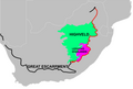
 Map-South Africa-Ukhahlamba Drakensberg01.png 1,131 × 1,159; 339 KB
-
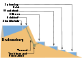
 Secció escarpament-drakensberg.jpg 1,402 × 518; 168 KB
-
 The Escarpment and the Drakensberg.jpg 9,960 × 6,756; 3.08 MB
-
 The Great Escarpment.jpg 9,910 × 6,960; 1.62 MB


