Category:Maps of the Demilitarized Zone of Korea
Jump to navigation
Jump to search
See also : Category:Conflicts by country
Ongoing armed conflicts ( Countries Maps )
|
|---|
|
National or regional Maps of ongoing insurgencies, armed conflicts, disputes of territories, military conflicts, and also current civil or international wars : Overview Maps:
National-wide Maps:
Sub-national-wide Maps:
See also:
Category:Conflicts in 2024 (with list of countries in ongoing armed conflicts) Template:City maps of ongoing civil wars (Local maps) |


.svg)


.svg)


.svg)


Note: Comments "areas of activity" means that this is not territorial control is shown.
Subcategories
This category has only the following subcategory.
Media in category "Maps of the Demilitarized Zone of Korea"
The following 15 files are in this category, out of 15 total.
-
 'DMZ평화의 길' 철원 구간.png 575 × 449; 175 KB
-
 6.25전쟁 전후 남북한 영토 변화.png 1,000 × 750; 203 KB
-
 Demilitarized Zone of Korea 04.JPG 3,488 × 2,616; 2.09 MB
-
 Demilitarized Zone of Korea 06.JPG 3,488 × 2,616; 2.09 MB
-
 Demilitarized Zone of Korea 15.JPG 2,616 × 3,488; 2.13 MB
-
 DMZ JOINT SECURITY AREA KAESONG CITY DPRK NORTH KOREA OCT 2012 (8643149352).jpg 4,883 × 3,066; 9.94 MB
-
 DMZ units.jpg 500 × 347; 39 KB
-
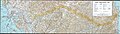 Korea demilitarized zone map - 1969.jpg 11,456 × 3,226; 13.25 MB
-
 Korean DMZ.jpg 1,007 × 769; 193 KB
-
 Map of Joint Security Area.svg 1,983 × 1,471; 577 KB
-
 Naval border islands between South Korea and North Korea.svg 912 × 653; 683 KB
-
 NJ-52.jpg 4,757 × 5,140; 6.45 MB
-

-

-
 The Korean Peninsula- Demilitarized Zone Area - DPLA - 5db5cdd85863984722e565b7ffcd80f7.jpg 2,554 × 3,280; 4.54 MB


.jpg)


.jpg)
.jpg)
