Category:Maps of the County of Mark
Jump to navigation
Jump to search
Media in category "Maps of the County of Mark"
The following 27 files are in this category, out of 27 total.
-
 "Comitatus Marchia et Ravensberg" (22257758455).jpg 3,836 × 3,011; 1.85 MB
-
-
 Berge ducatus Marck comitatus - CBT 5873821.jpg 5,715 × 4,750; 7.74 MB
-
 Blaeu 1645 - Comitatus Marchia et Ravensberg.jpg 3,619 × 3,019; 1.32 MB
-
 DucadosDeCléverisBergLaMarcaYJuliers1648.svg 766 × 666; 3.08 MB
-
 Duchy of Wesphalia and other states, circa 1645-es.svg 800 × 516; 178 KB
-
 Duchy of Wesphalia and other states, circa 1645.svg 800 × 516; 176 KB
-
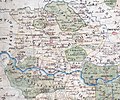
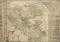
 Friedrich Christoph Müller - Grafschaft Mark (1791).jpg 3,074 × 2,448; 2.15 MB
-
 Grafschaft Mark 1681 Nicolas Sanson.jpg 7,240 × 5,875; 10.2 MB
-
 Grafschaft mark 1681 sanson.jpg 3,833 × 2,901; 9 MB
-
 Grafschaft Mark 1791 Friedrich C Mueller.jpg 2,033 × 1,800; 1.32 MB
-
 Grafschaft mark 1791 mueller.jpg 2,102 × 1,683; 4.78 MB
-
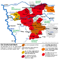 Grafschaft Mark Entwicklung.png 900 × 900; 480 KB
-
 Hertogdom Berg in 1477.JPG 168 × 193; 11 KB
-
 HRR 1648 (cropped- County of Moers).png 500 × 485; 97 KB
-
 KBMG1477.png 243 × 272; 123 KB
-

-

-

-
 Locator County of Mark (1560).svg 5,029 × 3,330; 575 KB
-
 Müller - Grafschaft Mark (1791).jpg 3,272 × 2,632; 3.04 MB
-
 Müller - Grafschaft Mark mit Illustration Burg Altena (1791).jpg 4,733 × 4,244; 5.42 MB
-
 Müller - Neue und vollständige Special-Situations Charte von der Grafschaft Marck (1775).jpg 14,397 × 10,201; 34.42 MB
-
 Müller - Topographische Charte der Grafschaft Marck (1777).jpg 14,176 × 10,213; 30.33 MB
-

-
 Triangulation der gesamten Grafschaft Mark 1789-1790.jpg 1,822 × 1,854; 981 KB
-
 Zones de cantonnement.png 1,808 × 2,083; 559 KB
.jpg)
.jpg)


.jpg)


.png)

.jpg)


.svg)
.jpg)
.jpg)
.jpg)
.jpg)
.jpg)

