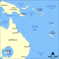
Category:Maps of the Coral Sea
Jump to navigation
Jump to search
Subcategories
This category has only the following subcategory.
B
- Battle of the Coral Sea maps (10 F)
Media in category "Maps of the Coral Sea"
The following 13 files are in this category, out of 13 total.
-
Admiralty Chart No 2355 Lizard Island to Cape Sidmouth, Published 1959.jpg 16,445 × 11,237; 38.84 MB
-
Admiralty Chart No 2763 Coral Sea and Great Barrier Reefs Australia Sheet 1, Published 1860.jpg 21,417 × 11,138; 62.16 MB
-
Admiralty Chart No 2764 Australia, Coral Sea and Great Barrier Reefs Sheet 2, Published 1860.jpg 11,840 × 7,898; 44.87 MB
-
Balls Pyramid, South Pacific Denham 1853 Nla.obj-231291098.jpg 8,826 × 10,628; 11.46 MB
-
Coral Sea blank.svg 942 × 600; 152 KB
-
Coral Sea es.svg 942 × 600; 198 KB
-
Coral Sea in its region.svg 500 × 281; 4.82 MB
-
Coral Sea map hu.png 800 × 800; 196 KB
-
Coral Sea map.png 2,000 × 2,000; 175 KB
-
Coral Sea mk.svg 943 × 600; 210 KB
-
Coral Sea.svg 943 × 600; 200 KB
-
Korallimeri.png 2,000 × 2,000; 522 KB


