Category:Maps of the City of Salford
Jump to navigation
Jump to search
Subcategories
This category has the following 2 subcategories, out of 2 total.
E
- Election maps of Salford (9 F)
Media in category "Maps of the City of Salford"
The following 74 files are in this category, out of 74 total.
-
 10 of 'Manchester. (A history of the town.)' (11186976154).jpg 1,952 × 1,264; 779 KB
-
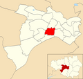
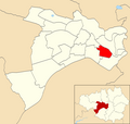
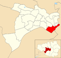
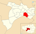
 Barton (Salford City Council ward).png 2,000 × 1,902; 303 KB
-
 Blackley and Broughton (UK Parliament constituency) 2018.png 4,022 × 3,628; 1.01 MB
-
 BlackleyBroughton2007Constituency.svg 322 × 242; 305 KB
-
 Boothstown and Ellenbrook (Salford City Council ward).png 2,000 × 1,902; 303 KB
-
 Broughton (Salford City Council ward).png 2,000 × 1,902; 303 KB
-
 Cadishead (Salford City Council ward).png 2,000 × 1,902; 302 KB
-
 Claremont (Salford City Council ward).png 2,000 × 1,902; 304 KB
-
 Eccles (Salford City Council ward).png 2,000 × 1,902; 304 KB
-
 EcclesConstituency.svg 329 × 242; 76 KB
-
 EnglandSalford.png 200 × 247; 30 KB
-
 GManc-Salford.png 200 × 151; 15 KB
-
 GreaterManchesterSalford.png 200 × 151; 16 KB
-
 Irlam (Salford City Council ward).png 2,000 × 1,902; 302 KB
-
 Irwell Riverside (Salford City Council ward).png 2,000 × 1,902; 303 KB
-
 Kersal (Salford City Council ward).png 2,000 × 1,902; 303 KB
-
 Langworthy (Salford City Council ward).png 2,000 × 1,902; 304 KB
-
 Little Hulton (Salford City Council ward).png 2,000 × 1,902; 303 KB
-
 Manchester Inner Ring Road map.png 3,466 × 2,484; 357 KB
-
 Manchester Metrolink Map 2008.svg 580 × 600; 82 KB
-
 Manchester Metrolink Map.png 620 × 314; 36 KB
-
 Manchester Metrolink Map.svg 375 × 600; 77 KB
-
 Manchester OS Opendata Map.jpg 3,380 × 2,351; 2.4 MB
-
 Manchester parish map.svg 913 × 813; 246 KB
-
 Manchester Ship Canal map.svg 3,119 × 1,483; 47 KB
-
 Manchester Street Plan 2011.jpg 2,828 × 2,259; 3.6 MB
-
 Manchester WV map.png 1,200 × 1,151; 1.04 MB
-
 ManchesterMaps.svg 1,052 × 744; 904 KB
-
 Map of the Manchester Bolton and Bury Canal with east lancs line.gif 1,515 × 1,656; 92 KB
-
 Map of the Manchester Bolton and Bury Canal.gif 1,515 × 1,656; 85 KB
-
 Map of the Manchester Bolton and Bury Canal.svg 1,100 × 1,293; 59 KB
-
 MBB canal map.gif 588 × 838; 24 KB
-
 Mbb canal map.svg 724 × 1,024; 28 KB
-
 Metrolink 2CC.png 500 × 361; 54 KB
-
 Metrolink full network.png 500 × 361; 58 KB
-
 Metrolink Manchester Map.png 1,584 × 506; 55 KB
-
 Metrolink mediacity extensi.png 500 × 361; 41 KB
-
 Metrolink network 2000.png 500 × 361; 40 KB
-
 Metrolink phase south manchester line.png 500 × 361; 50 KB
-
 Metrolink phase2.png 500 × 361; 39 KB
-
 Metrolink phase3 complete.png 500 × 361; 62 KB
-
 Metrolink phase3 east manchester.png 500 × 361; 43 KB
-
 Metrolink phase3 rochdale.png 500 × 361; 46 KB
-
 Metrolink phase3a.png 500 × 361; 50 KB
-
 Metrolink phase3b.png 500 × 361; 55 KB
-
 Metrolink Trafford Line.png 500 × 361; 51 KB
-
 Ordsall (Salford City Council ward).png 2,000 × 1,902; 303 KB
-
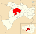
 Pendlebury (Salford City Council ward).png 2,000 × 1,902; 302 KB
-
 River Mersey map.png 1,403 × 571; 1.18 MB
-
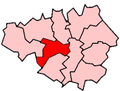
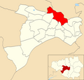
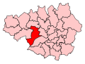
 Salford and Eccles (UK Parliament constituency).png 2,000 × 1,902; 293 KB
-
 Salford City Council composition 2017.png 360 × 185; 15 KB
-
 Salford City Council composition 2017.svg 360 × 185; 3 KB
-
 Salford City Council composition 2018.svg 360 × 185; 3 KB
-
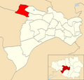
 Salford City Council Wards Numbered.png 2,000 × 1,902; 332 KB
-
 Salford city map.svg 1,000 × 1,000; 12 KB
-
 Salford hundred map.png 2,000 × 1,966; 449 KB
-
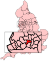
 Salford UK locator map.svg 1,425 × 993; 860 KB
-
 Salford UK ward map 2010 (blank).svg 1,372 × 1,305; 264 KB
-
 SalfordConstituency.svg 329 × 242; 76 KB
-
 SalfordEccles2007Constituency.svg 322 × 242; 305 KB
-
 SalfordEcclesConstituency.svg 1,000 × 700; 95 KB
-
 Salfordshire.png 680 × 534; 417 KB
-
 Ship canal map.png 4,678 × 2,224; 759 KB
-
 Swinton North (Salford City Council ward).png 2,000 × 1,902; 303 KB
-
 Swinton South (Salford City Council ward).png 2,000 × 1,902; 303 KB
-
 Walkden North (Salford City Council ward).png 2,000 × 1,902; 303 KB
-
 Walkden South (Salford City Council ward).png 2,000 × 1,902; 303 KB
-
 Weaste & Seedley (Salford City Council ward).png 2,000 × 1,902; 303 KB
-
 Winton (Salford City Council ward).png 2,000 × 1,902; 303 KB
-
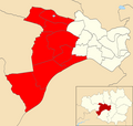
 Worsley (Salford City Council ward).png 2,000 × 1,902; 302 KB
-
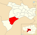
 Worsley and Eccles South (UK Parliament constituency).png 2,000 × 1,902; 288 KB
-
 WorsleyConstituency.svg 329 × 242; 76 KB
-
 WorsleyEcclesSouth2007Constituency.svg 322 × 242; 305 KB
-
 WorsleyEcclesSouthConstituency.svg 1,000 × 700; 198 KB
%27_(11186976154).jpg)
.png)
_2018.png)

.png)
.png)
.png)
.png)
.png)


.png)
.png)
.png)
.png)
.png)


.png)
.png)
.png)


.png)
.png)
.png)
.png)
.png)
.png)
.png)
.png)


.svg)