Category:Maps of the Chernobyl disaster
Jump to navigation
Jump to search
Subcategories
This category has the following 2 subcategories, out of 2 total.
Media in category "Maps of the Chernobyl disaster"
The following 6 files are in this category, out of 6 total.
-
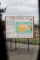 Chernobyl contamination zone gate 2009.jpg 2,592 × 3,888; 1.62 MB
-
 Chernobyl Nuclear Power Plant.PNG 415 × 422; 16 KB
-
 Chernobyl- Before, During, and After.jpg 2,262 × 750; 2.3 MB
-
 Chernobylskyi-Raion (1923-1988).png 315 × 400; 74 KB
-
 Copernicus Sentinel-2 maps Chernobyl fire.gif 1,755 × 1,273; 4.51 MB
-
 Polesie State Radioecological Reserve (OpenStreetMap).png 1,160 × 950; 444 KB

.png)

.png)