Category:Maps of the Chagatai Khanate
Jump to navigation
Jump to search
Media in category "Maps of the Chagatai Khanate"
The following 23 files are in this category, out of 23 total.
-
 C. 1330 Western Asia under Mongols.jpg 3,993 × 3,000; 3.93 MB
-
 1335இல் ஆசியா.svg 512 × 396; 1.35 MB
-
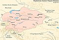
 1372 Moghulistan.png 1,199 × 809; 1.74 MB
-
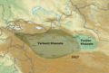 1517 Yarkent and Turpan.png 1,199 × 809; 1.77 MB
-
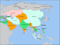
 Asia in 1335 cs.svg 1,100 × 837; 763 KB
-
 Asia in 1335-ar.svg 1,100 × 837; 1.02 MB
-
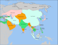
 Asia in 1335-es.svg 1,100 × 837; 1.02 MB
-
 Asia in 1335-it.svg 1,100 × 837; 1.03 MB
-
 Asia in 1335.svg 1,100 × 837; 1.02 MB
-
 Chagatai 14th century.jpg 2,261 × 1,386; 4.13 MB
-
 Chagatai Khanate (1490).png 1,202 × 677; 792 KB
-
 Chagatai Khanate late 13th century locator map.svg 811 × 646; 278 KB
-
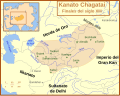
 Chagatai Khanate map en.svg 811 × 646; 468 KB
-
 Chagatai Khanate map es.svg 811 × 646; 242 KB
-
 Chagatai Khanate map Masry.PNG 753 × 600; 136 KB
-
 Chagatai Khanate map pt.svg 811 × 646; 243 KB
-
 ChagataiKhanate1300.png 1,644 × 959; 53 KB
-
 Eastern Chagatai 1372.jpg 1,103 × 750; 190 KB
-
 Mongol Empire map 1259.png 752 × 591; 20 KB
-
 Mongol Empire map 1297.png 752 × 591; 21 KB
-
 Mongol Empire map 2.gif 752 × 591; 165 KB
-
 MongolEmpireDivisions1300.png 1,644 × 959; 37 KB
-
 Reich Tschagatai.png 752 × 592; 37 KB


.png)


