Category:Maps of the Central District (Israel)
Jump to navigation
Jump to search
Media in category "Maps of the Central District (Israel)"
The following 21 files are in this category, out of 21 total.
-
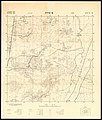 14-18-ATira-1948.jpg 7,051 × 8,326; 7.62 MB
-
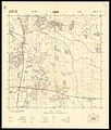 14-19-Cacoun-1948.jpg 7,090 × 8,350; 7.35 MB
-
 14-19-KfarHaim-1949.jpg 6,940 × 8,410; 7.36 MB
-
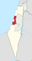
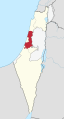
 Central district in Israel.svg 361 × 1,000; 2.33 MB
-
 מחוז המרכז.JPG 183 × 282; 19 KB
-
 Center District in Israel (+disputed hatched) (semi-Israel areas hatched).svg 614 × 1,141; 345 KB
-
 Center District in Israel (+disputed hatched).svg 614 × 1,141; 285 KB
-
 Center District in Israel (+disputed) (semi-Israel areas hatched).svg 614 × 1,141; 342 KB
-
 Center District in Israel (+disputed).svg 614 × 1,141; 281 KB
-
 Center District in Israel (undisputed) (semi-Israel areas hatched).svg 614 × 1,141; 338 KB
-
 Center District in Israel (undisputed).svg 614 × 1,141; 280 KB
-
 Israel center dist.png 262 × 727; 36 KB
-
 Israel center dist.svg 540 × 990; 76 KB
-
 Israel-Central.png 100 × 301; 3 KB
-
 Septem-Israel location Center.svg 200 × 510; 81 KB
-
 HaSharon subdistrict in Israel.svg 361 × 1,000; 2.33 MB
-
 HaMeshulash locator map.png 744 × 746; 67 KB
-
 Petah Tikva subdistrict in Israel.svg 361 × 1,000; 2.46 MB
-
 Ramla subdistrict in Israel.svg 361 × 1,000; 2.33 MB
-
 Rehovot subdistrict in Israel.svg 361 × 1,000; 2.4 MB
-
 Map-sharonn.png 986 × 1,795; 833 KB


_(semi-Israel_areas_hatched).svg)
.svg)
_(semi-Israel_areas_hatched).svg)
.svg)
_(semi-Israel_areas_hatched).svg)
.svg)


