Category:Maps of the Central African Republic Civil War (2012–present)
Appearance
Media in category "Maps of the Central African Republic Civil War (2012–present)"
The following 15 files are in this category, out of 15 total.
-
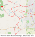
Bangui2021.png 887 × 939; 466 KB
-
Batangafoclashes.png 762 × 637; 333 KB
-
Bria2021.svg 1,200 × 1,070; 1.45 MB
-
CAR2014.svg 1,606 × 1,109; 1.46 MB
-
CAR2021.svg 1,606 × 1,109; 4.98 MB
-
Central African Republic 2012 Battles-en.svg 1,606 × 1,109; 5.72 MB
-
Central African Republic map (Seleka rebellion March 2013).png 618 × 426; 635 KB
-
CentralAfricanRepublic2017.svg 1,606 × 1,109; 913 KB
-
ECDM 20131213 CAR DisplacedPeople.pdf 1,625 × 1,125; 442 KB
-
Francafrique map.png 4,463 × 3,228; 5.3 MB
-
Ndeleoffensive.png 2,310 × 1,706; 596 KB
-
PK5district.svg 2,221 × 1,793; 3.81 MB
-
Selekaadvances.svg 1,606 × 1,109; 482 KB
-
War in Central African Republic he.svg 1,606 × 1,109; 951 KB
-
War in Central African Republic.svg 1,606 × 1,109; 7.64 MB


