Category:Maps of the Captaincy General of Cuba
Jump to navigation
Jump to search
Media in category "Maps of the Captaincy General of Cuba"
The following 17 files are in this category, out of 17 total.
-

-
 1591 De Bry and Le Moyne Map of Florida and Cuba - Geographicus - Florida-debry-1591.jpg 4,500 × 3,480; 6.38 MB
-
 Spanish Caribbean Islands in the American Viceroyalties 1600.png 1,600 × 953; 384 KB
-
 1763 Terreni - Coltellini Map of Cuba and Jamaica - Geographicus - Cuba-terrini-1763.jpg 3,985 × 3,209; 2.9 MB
-
 1780 Raynal and Bonne Map of Cuba, West Indies - Geographicus - Cuba-bonne-1780.jpg 2,500 × 1,746; 1.31 MB
-

-
 1815 Thomson Map of Cuba. Bermuda ^ the Bahamas - Geographicus - Cuba-t-1816.jpg 3,500 × 2,993; 2.07 MB
-
 1855 Colton Map of Cuba, Jamaica and Porto Rico - Geographicus - Cuba-colton-1855.jpg 4,000 × 3,328; 4.1 MB
-
 DeBry Map of Caribbean & Florida1594.jpg 3,576 × 2,673; 9.23 MB
-
 Mapa de La Habana Vieja.JPG 2,048 × 1,536; 609 KB
-
 Mapa del Virreinato de la Nueva España (1794).svg 885 × 758; 1.41 MB
-
 Mapa del Virreinato de la Nueva España (1819).svg 885 × 664; 1.06 MB
-
 Spain, 1873-74.png 1,625 × 1,016; 271 KB
-
 The Spanish Borderlands (1921), map of New Spain (fragment).jpg 1,858 × 4,113; 1.15 MB
-
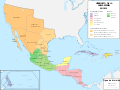
 Viceroyalty of New Spain Location 1819 (without Philippines).png 1,157 × 857; 242 KB
-
 Viceroyalty of the New Spain 1800 (without Philippines).png 1,600 × 1,192; 645 KB
-
 Viceroyalty of the New Spain 1819 (without Philippines).png 1,600 × 1,192; 668 KB


.svg)
.svg)

,_map_of_New_Spain_(fragment).jpg)
.png)
.png)
.png)