Category:Maps of the Captaincy General of Chile
Jump to navigation
Jump to search
Media in category "Maps of the Captaincy General of Chile"
The following 15 files are in this category, out of 15 total.
-
 Captaincy General of Chile (orthographic projection).svg 550 × 550; 844 KB
-
 Bandera mapa de la Capitanía General de Chile, 1775.svg 1,579 × 3,543; 1.35 MB
-
 Bandera mapa de la Capitanía General de Chile, 1776.svg 1,575 × 3,543; 3.19 MB
-
 Capitanía General de Chile, 1775, mapa satelital.svg 1,710 × 2,684; 8.84 MB
-
 Capitanía General de Chile, 1775.svg 1,710 × 2,684; 4.53 MB
-
 Capitanía General de Chile, 1776.svg 1,710 × 2,684; 4.77 MB
-
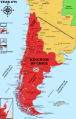
 Capitanía General de Chile, 1810 (Uti possidetis iuris).svg 1,710 × 2,684; 5.8 MB
-
 Captaincy General of Chile, 1775.svg 1,710 × 2,684; 4.5 MB
-
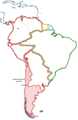
 Chile location map (+claims, 1775).svg 1,710 × 2,679; 2.2 MB
-
 Chile location map (+claims, 1776).svg 1,710 × 2,679; 3.06 MB
-
 Colchagua-1750 01.png 2,550 × 3,300; 3.97 MB
-
 Colchagua-1800.png 2,550 × 3,300; 4.01 MB
-
 Cuyo en la Capitanía General de Chile.svg 1,710 × 2,679; 2.53 MB
-
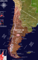
 Mapa Capitania Chile.png 1,038 × 1,599; 470 KB
-
 Parte sudamericana del Reino de Chile.svg 1,576 × 3,543; 674 KB
.svg)


.svg)

.svg)
.svg)


