Category:Maps of the Buffalo River (New York)
Jump to navigation
Jump to search
Media in category "Maps of the Buffalo River (New York)"
The following 13 files are in this category, out of 13 total.
-
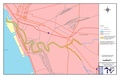 Buffalo River - final state approved.pdf 2,550 × 1,650; 545 KB
-
 Buffalo, Double Page Plate No. 15 (Map bounded by Wabash St., Hamburg Canal, Katharine St., Buffalo River) NYPL2055431.tiff 7,015 × 5,261, 2 pages; 105.85 MB
-
 Buffalo, Double Page Plate No. 3 (Map bounded by Exchange St., Ohio Basin Slip, Miami St., Buffalo Harbor, Main St.) NYPL2055419.tiff 7,203 × 5,402, 2 pages; 111.59 MB
-
 Buffalo, Double Page Plate No. 4 (Map bounded by Buffalo River, Louisiana St., Lake Erie) NYPL2055420.tiff 7,203 × 5,402, 2 pages; 111.59 MB
-
 Buffalo, V. 2, Double Page Plate No. 35 (Map bounded by Buffalo River, Ohio St., Lake Erie) NYPL2056922.tiff 7,216 × 5,412, 2 pages; 112 MB
-
 Buffalo, V. 2, Double Page Plate No. 36 (Map bounded by Elk St., Buffalo River, Michigan Ave.) NYPL2056923.tiff 7,216 × 5,412, 2 pages; 112 MB
-

-

-

-

-
 Buffalo, V. 2, Double Page Plate No. 53 (Map bounded by Sandusky St., Lake Erie) NYPL2056940.tiff 7,216 × 5,412, 2 pages; 112 MB
-
 Buffalo-1905.jpg 989 × 586; 279 KB
-
 EPA map of the Buffalo River - final-state-approved 1.gif 1,223 × 792; 135 KB

