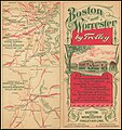
Category:Maps of the Boston and Worcester Street Railway
Jump to navigation
Jump to search
Media in category "Maps of the Boston and Worcester Street Railway"
The following 10 files are in this category, out of 10 total.
-
1904 Boston and Worcester Street Railway bird's eye view map.jpg 18,385 × 4,894; 36.46 MB
-
1908 map of streetcar lines between Boston and Worcester.jpg 901 × 364; 101 KB
-
1908 map of the Boston and Worcester Street Railway and connections.jpg 1,943 × 1,709; 844 KB
-
1908 map of the Boston and Worcester Street Railway.jpg 1,378 × 867; 246 KB
-
1912 Boston and Worcester Street Railway track map - left.png 3,866 × 2,500; 9.84 MB
-
1912 Boston and Worcester Street Railway track map - right.png 3,852 × 2,500; 12.9 MB
-
1915 diagram of trolley freight connections in Massachusetts.jpg 2,010 × 1,463; 244 KB
-
1921 map of Electric Express and B&W freight service.jpg 1,200 × 943; 130 KB
-
Boston and Worcester.png 3,085 × 848; 101 KB
-
Cover of Boston and Worcester Street Railway brochure.jpg 4,639 × 4,944; 6.95 MB


