Category:Maps of the Borough of Pendle
Jump to navigation
Jump to search
Media in category "Maps of the Borough of Pendle"
The following 41 files are in this category, out of 41 total.
-
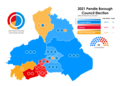 2021 pendle borough council election results map.png 2,388 × 1,708; 386 KB
-
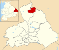
 Barrowford UK ward locator map.svg 1,425 × 1,214; 313 KB
-
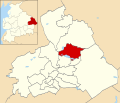
 Blacko and Higherford UK ward locator map.svg 1,425 × 1,214; 313 KB
-
 Borough of Pendle parishes map.svg 1,425 × 1,214; 1.63 MB
-
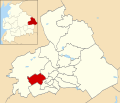
 Boulsworth UK ward locator map.svg 1,425 × 1,214; 313 KB
-
 Bradley UK ward locator map.svg 1,425 × 1,214; 313 KB
-
 Brierfield UK ward locator map.svg 1,425 × 1,214; 313 KB
-
 Clover Hill UK ward locator map.svg 1,425 × 1,214; 313 KB
-
 Coates UK ward locator map.svg 1,425 × 1,214; 313 KB
-
 Craven UK ward locator map.svg 1,425 × 1,214; 313 KB
-
 Earby UK ward locator map.svg 1,425 × 1,214; 313 KB
-
 Foulridge UK ward locator map.svg 1,425 × 1,214; 313 KB
-
 Higham and Pendleside UK ward locator map.svg 1,425 × 1,214; 313 KB
-
 Horsfield UK ward locator map.svg 1,425 × 1,214; 313 KB
-
 LancashirePendle.png 200 × 250; 19 KB
-
 Location map United Kingdom Borough of Pendle.svg 1,425 × 1,214; 2.25 MB
-
 Marsden UK ward locator map.svg 1,425 × 1,214; 313 KB
-
 Old Laund Booth UK ward locator map.svg 1,425 × 1,214; 313 KB
-
 Pendle 2006 election map.png 472 × 406; 56 KB
-
 Pendle 2007 election map.png 472 × 406; 49 KB
-
 Pendle 2008 election map.png 472 × 406; 55 KB
-
 Pendle UK local election 2002 map.svg 1,425 × 1,214; 315 KB
-
 Pendle UK local election 2003 map.svg 1,425 × 1,214; 313 KB
-
 Pendle UK local election 2004 map.svg 1,425 × 1,214; 313 KB
-
 Pendle UK local election 2006 map.svg 1,425 × 1,214; 313 KB
-
 Pendle UK local election 2007 map.svg 1,425 × 1,214; 313 KB
-
 Pendle UK local election 2008 map.svg 1,425 × 1,214; 313 KB
-
 Pendle UK local election 2010 map.svg 1,425 × 1,214; 313 KB
-
 Pendle UK local election 2011 map.svg 1,425 × 1,214; 313 KB
-
 Pendle UK local election 2012 map.svg 1,425 × 1,214; 313 KB
-
 Pendle UK local election 2014 map.svg 1,425 × 1,214; 313 KB
-
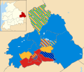
 Pendle UK local election 2019 map.svg 1,425 × 1,214; 320 KB
-
 Pendle UK locator map.svg 1,116 × 1,305; 1.25 MB
-
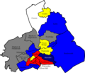
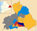
 Pendle UK political composition map.svg 1,425 × 1,214; 316 KB
-
 Pendle UK ward map 2010 (blank).svg 1,425 × 1,214; 313 KB
-
 Reedley UK ward locator map.svg 1,425 × 1,214; 313 KB
-
 Southfield UK ward locator map.svg 1,425 × 1,214; 313 KB
-
 Vivary Bridge UK ward locator map.svg 1,425 × 1,214; 313 KB
-
 Walverden UK ward locator map.svg 1,425 × 1,214; 313 KB
-
 Waterside UK ward locator map.svg 1,425 × 1,214; 313 KB
-
 Whitefield UK ward locator map.svg 1,425 × 1,214; 313 KB


.svg)