Category:Maps of the Black Forest
Jump to navigation
Jump to search
Subcategories
This category has the following 3 subcategories, out of 3 total.
L
Media in category "Maps of the Black Forest"
The following 48 files are in this category, out of 48 total.
-

-

-

-

-
 ArmyofDanubethroughSchwarzwald.svg 1,200 × 1,518; 1.02 MB
-
 Belchen-schwarzwald.jpg 300 × 250; 23 KB
-
 Black Forest (PSF).png 882 × 590; 159 KB
-
 BlackForest-Position-green.png 188 × 235; 8 KB
-
 BlackForest-Position.svg 1,075 × 1,273; 610 KB
-
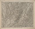
 Cosmographia - Beschreibung aller Lender durch Sebastianum Munsterum (1545) 15.jpg 11,031 × 7,110; 7.45 MB
-
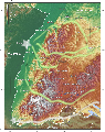
 DEMBlackForest.png 1,996 × 2,230; 6.65 MB
-
 DEMsuedlicher-oberrhein.jpg 3,172 × 2,084; 833 KB
-
 Doppelschleifen der Schwarzwaldbahn bei Triberg.png 1,106 × 1,635; 618 KB
-
 Einzugsgebiet und Flusssystem der Wiese.jpg 735 × 825; 209 KB
-
 Eisenbahnrouten nach dem Schwarzwald und den Vogesen - btv1b102232370.jpg 2,534 × 2,985; 1.41 MB
-
 Elz-schwarzwald.png 656 × 644; 832 KB
-
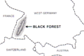
 Germany Wikivoyage locator maps - Black Forest.png 551 × 652; 146 KB
-
 Hoellentalbahn gmt.png 1,200 × 627; 1.25 MB
-
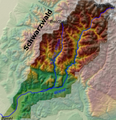
 Hotzenwald Region.gif 600 × 657; 58 KB
-
 Karte Albtal Ende 18. Jahrhundert.jpg 1,920 × 2,560; 5.07 MB
-
 Karte Region Hotzenwald.png 1,515 × 900; 1.34 MB
-

-
 Karte-schattenmuehle.jpg 460 × 289; 70 KB
-
 Kniebis3schanzen.jpg 1,440 × 720; 1.04 MB
-
 LASB K Hellwig 0310.jpg 6,804 × 5,496; 13.31 MB
-
 LASB K Hellwig 0668.jpg 3,720 × 6,048; 7.85 MB
-
 Map Swabia small 1600.jpg 800 × 600; 143 KB
-
 Naturraeumliche Grossregionen Deutschlands, Schwarzwald.png 1,827 × 2,318; 5.87 MB
-
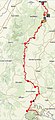 Ostweg Pforzheim Schaffhausen.jpg 316 × 691; 152 KB
-
 Ostweg, Etappe Freudenstadt - Alpirsbach.jpg 498 × 885; 392 KB
-
 Ostweg, Pforzheim - Bad Liebenzell, Germany.jpg 1,080 × 1,731; 622 KB
-
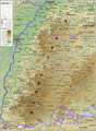
 Relief Map of Germany, Black Forest.png 1,000 × 1,185; 1.48 MB
-
 Reliefkarte Freiburg und Umgebung.jpg 3,116 × 2,510; 3.26 MB
-
 Schauinsland.jpg 2,500 × 2,500; 5.11 MB
-
 Schwarzwald - Deutsche Mittelgebirge, Serie A-de.png 2,500 × 3,400; 12.29 MB
-
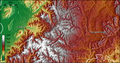
 Schwarzwald topo.jpg 1,200 × 1,518; 1.24 MB
-
 Schwarzwald-topographie.png 1,820 × 3,030; 7.34 MB
-
 SchwarzwaldUndSchwäbischAlb.png 655 × 455; 592 KB
-
 Stebenhaber schweden.jpg 1,404 × 734; 453 KB
-
 Topographic Map of Trier - NARA - 100384427 (page 2).jpg 6,924 × 6,079; 14.06 MB
-
 Upper Rhine plain with Fessenheim location - photomap-fr.svg 1,237 × 1,742; 1.05 MB
-
 Verlaufskarte Dreiseenbahn 2.png 1,000 × 904; 955 KB
-
 Verlaufskarte Dreiseenbahn.jpg 800 × 638; 149 KB
-
 Wanderportal Altes-Schloss.jpg 2,491 × 1,896; 1 MB
-
 Wanderportal am Mahlberg.JPG 2,560 × 1,920; 2.09 MB
-
 Wanderportal-Risswasen.JPG 3,456 × 5,184; 7.44 MB
-
 Wiesental-schwarzwald.png 538 × 558; 533 KB
-
 Wildbad-Pforzheim-Caul - btv1b8445264b.jpg 8,718 × 9,202; 14.6 MB
%27_(11129323103).jpg)
%27_(11129354965).jpg)
%27_(11129249336).jpg)
%27_(11128933984).jpg)


.png)


_15.jpg)


.jpg)


