Category:Maps of the Berlin Wall
Jump to navigation
Jump to search
Media in category "Maps of the Berlin Wall"
The following 19 files are in this category, out of 19 total.
-
Berlin satellite image with Berlin wall.jpg 1,506 × 1,347; 481 KB
-
Berlin wall with tunnels.png 500 × 509; 44 KB
-
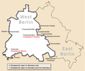
Berlin-wall-map-HE.png 571 × 482; 67 KB
-
Berlin-wall-map.png 571 × 482; 67 KB
-
Berlinwall hu v5.png 1,368 × 1,100; 904 KB
-
Die Berliner Mauer - Planet Wissen.webm 1 min 41 s, 1,920 × 1,080; 166.09 MB
-
Entenschnabel mit Grenzen und Straßen.jpg 1,500 × 709; 268 KB
-
Karte berliner mauer de.jpg 748 × 600; 221 KB
-
Karte berliner mauer de.png 1,366 × 1,098; 133 KB
-
Karte berliner mauer de19xx.png 1,366 × 1,098; 1.23 MB
-
Karte berliner mauer en.jpg 1,368 × 1,100; 244 KB
-
Karte berliner mauer es.jpg 1,368 × 1,100; 161 KB
-
Karte berliner mauer pt.jpg 1,368 × 1,100; 247 KB
-
Karte berliner mauer ru.png 640 × 512; 42 KB
-
Karte berliner mauer-fr.png 1,368 × 1,100; 866 KB
-
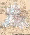
Wberlin transport 78.jpg 1,164 × 1,352; 1.08 MB


