Category:Maps of the Battle of Quatre Bras
Jump to navigation
Jump to search
Media in category "Maps of the Battle of Quatre Bras"
The following 13 files are in this category, out of 13 total.
-
 Battle of Quatre Bras, 16 June 1815 (Alison).jpg 4,300 × 3,424; 2.67 MB
-

-

-
 EB1911-28-0376-a-Waterloo Campaign, Map II.jpg 868 × 717; 279 KB
-
 Plan of the Battlefields of Ligny and Quatre Bras.jpg 4,575 × 3,745; 5.89 MB
-
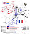
 Waterloo Campaign map-alt2 (french).svg 1,500 × 1,706; 704 KB
-
 Waterloo Campaign map-alt2.svg 1,500 × 1,706; 1.04 MB
-
 Waterloo Campaign map-alt3 cs.svg 1,500 × 1,706; 602 KB
-
 Waterloo Campaign map-alt3.svg 1,500 × 1,706; 1.04 MB
-

-
 Alison's history of Europe atlas 1850 (92105365).jpg 6,916 × 5,841; 6.56 MB
-

-

.jpg)
.jpg)
%27_(11178356414).jpg)


.svg)


_(14779658234).jpg)
.jpg)
.jpg)
.jpg)