Category:Maps of the Battle of Hill 70
Jump to navigation
Jump to search
Media in category "Maps of the Battle of Hill 70"
The following 3 files are in this category, out of 3 total.
-
 Battle of Hill 70 - local planning map.jpg 21,871 × 15,837; 42.02 MB
-
 British defences of Hill 70, Vimy Ridge & Arras previous to March 1918 (5003772).jpg 3,803 × 5,000; 2.91 MB
-
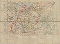
 Hill 70 - Map of harassing fire.jpg 2,800 × 2,295; 1.45 MB

.jpg)
