Category:Maps of the Battle of Antietam
Jump to navigation
Jump to search
Media in category "Maps of the Battle of Antietam"
The following 79 files are in this category, out of 79 total.
-
"Antietam Sharpsburg and Vicinity.".jpg 4,295 × 5,337; 6.78 MB
-
(Map of the battlefield of Antietam LOC 2008621643.jpg 7,983 × 9,826; 11.98 MB
-
(Map of the battlefield of Antietam LOC 2008621643.tif 7,983 × 9,826; 224.42 MB
-
(No. 2) Map of the battlefield of Antietam LOC 99447387.jpg 9,026 × 10,790; 13.38 MB
-
(No. 2) Map of the battlefield of Antietam LOC 99447387.tif 9,026 × 10,790; 278.64 MB
-
(Northwest, or no. 1 sheet of preliminary map of Antietam (Sharpsburg) battlefield). LOC 2005625020.tif 10,642 × 8,804; 268.06 MB
-
121 of 'A Bird's-Eye View of our Civil War' (11283244545).jpg 1,141 × 1,383; 260 KB
-
185 of 'History of the American War' (11070476325).jpg 2,448 × 1,538; 571 KB
-
467 of 'History of the American Civil War, etc' (11059426376).jpg 732 × 955; 174 KB
-
Abraham Lincoln - a history (1914) (14790092033).jpg 1,796 × 1,896; 799 KB
-
Antietam - Afternoon Phase.JPG 267 × 373; 13 KB
-
Antietam - Midday Phase.JPG 296 × 372; 15 KB
-
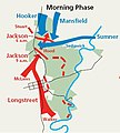
Antietam - Morning Phase.JPG 333 × 371; 20 KB
-
Antietam Battle Map.jpg 2,568 × 2,968; 800 KB
-
Antietam Battle Map.png 629 × 741; 127 KB
-
Antietam Overview a.svg 948 × 1,234; 3.19 MB
-
Antietam Overview.png 4,800 × 6,000; 16.42 MB
-
Antietam, Cornfield 7-20 AM.jpg 1,571 × 1,530; 722 KB
-
Antietam, Cornfield 8 A.M.jpg 1,250 × 1,195; 439 KB
-
Antietam, Cornfield 8-40 A.M.jpg 1,546 × 1,311; 605 KB
-
Antietam0600 a.svg 473 × 561; 2.86 MB
-
Antietam0600.png 4,800 × 6,000; 14.4 MB
-
Antietam0730 a.svg 473 × 561; 2.81 MB
-
Antietam0730.png 4,800 × 6,000; 14.35 MB
-
Antietam0900 125PA 34NY 07MI.png 789 × 935; 431 KB
-
Antietam0900 a.svg 473 × 561; 2.99 MB
-
Antietam0900.png 4,800 × 6,000; 13.46 MB
-
Antietam1000 a.svg 489 × 563; 2.76 MB
-
Antietam1000-HE.png 789 × 975; 266 KB
-
Antietam1000.png 4,800 × 6,000; 13.73 MB
-
ATLAS BATTLEFIELD ANTIETAM ca000005 MAP01.jpg 8,525 × 10,485; 12.66 MB
-
ATLAS BATTLEFIELD ANTIETAM ca000006 MAP02.jpg 8,530 × 10,531; 12.97 MB
-
ATLAS BATTLEFIELD ANTIETAM ca000007 MAP03.jpg 8,594 × 10,589; 13.24 MB
-
ATLAS BATTLEFIELD ANTIETAM ca000008 MAP04.jpg 8,642 × 10,565; 12.75 MB
-
ATLAS BATTLEFIELD ANTIETAM ca000009 MAP05.jpg 8,567 × 10,511; 13.32 MB
-
ATLAS BATTLEFIELD ANTIETAM ca000010 MAP06.jpg 8,559 × 10,648; 13.14 MB
-
ATLAS BATTLEFIELD ANTIETAM ca000011 MAP07.jpg 8,580 × 10,571; 13.18 MB
-
ATLAS BATTLEFIELD ANTIETAM ca000012 MAP08.jpg 8,541 × 10,530; 13.13 MB
-
ATLAS BATTLEFIELD ANTIETAM ca000013 MAP09.jpg 8,487 × 10,462; 13.59 MB
-
ATLAS BATTLEFIELD ANTIETAM ca000014 MAP10.jpg 8,574 × 10,561; 12.93 MB
-
ATLAS BATTLEFIELD ANTIETAM ca000015 MAP11.jpg 8,541 × 10,512; 12.89 MB
-
ATLAS BATTLEFIELD ANTIETAM ca000016 MAP12.jpg 8,528 × 10,478; 13.1 MB
-
ATLAS BATTLEFIELD ANTIETAM ca000017 MAP13.jpg 8,589 × 10,647; 12.96 MB
-
ATLAS BATTLEFIELD ANTIETAM ca000018 MAP14.jpg 8,660 × 10,631; 13.55 MB
-
Battle of Antiatem.jpg 800 × 495; 111 KB
-
History of the Civil War in America (1875) (14576180908).jpg 3,266 × 2,572; 2.3 MB
-
Map of Antietam, Sharpsburg, and Vicinity - NARA - 109182883.jpg 2,816 × 3,756; 1,013 KB
-
Map of Battlefield of Antietam - NARA - 137929252.jpg 8,232 × 9,825; 4.67 MB
-
Map of the Battlefield of Antietam - NARA - 109182857.jpg 6,240 × 8,470; 5.87 MB
-
Map of the Battlefield of Antietam - NARA - 109182879.jpg 8,192 × 10,100; 8.42 MB
-
Map of the Battlefield of Antietam - NARA - 109182881.jpg 8,288 × 9,926; 7.81 MB
-
Map of the Battlefield of Antietam - NARA - 137929235.jpg 9,440 × 10,455; 5.96 MB
-
Map of the Battlefield of Antietam - NARA - 137929247 (page 1).jpg 12,642 × 7,808; 5.68 MB
-
Map of the Battlefield of Antietam - NARA - 137929247 (page 2).jpg 12,521 × 8,204; 15.77 MB
-
Map of the Battlefield of Antietam - NARA - 137929250.jpg 8,164 × 10,011; 5.83 MB
-
Mapofthe battlefieldofantietam.jpg 1,472 × 1,860; 770 KB
-
Maryland Campaign (September 10—13, 1862) - ru.svg 1,332 × 943; 593 KB
-
Maryland Campaign (September 3—9, 1862) - ru.svg 1,111 × 1,003; 517 KB
-
Robert E. Lee and the Southern Confederacy, 1807-1870 (1897) (14778246514).jpg 1,586 × 2,064; 325 KB
-
The century illustrated monthly magazine (1882) (14583648240).jpg 2,762 × 3,682; 2.24 MB
-
The field of Antietam. LOC 99447395.jpg 2,537 × 3,667; 1.57 MB
-
The field of Antietam. LOC 99447395.tif 2,537 × 3,667; 26.62 MB
-
US ARMY MARYLAND CAMPAIGN MAP 1.jpg 2,947 × 2,114; 988 KB
-
US ARMY MARYLAND CAMPAIGN MAP 2.jpg 1,306 × 2,114; 405 KB
-
US ARMY MARYLAND CAMPAIGN MAP 3 (SOUTH MOUNTAIN).jpg 1,370 × 1,864; 385 KB
-
US ARMY MARYLAND CAMPAIGN MAP 4 (ANTIETAM).jpg 2,742 × 2,304; 1.55 MB
-
US ARMY MARYLAND CAMPAIGN MAP 5 (ANTIETAM).jpg 1,324 × 2,132; 354 KB
-
Antietam Overview1.png 835 × 1,096; 255 KB
-
WPMA01 Antietam Campaign.jpg 3,200 × 2,459; 5.96 MB
-
WPMA02 ANTIETAM 16 09.png 927 × 1,203; 454 KB
-
WPMA03 ANTIETAM 17 09 DAWN.png 930 × 1,198; 516 KB


