Category:Maps of the Atacama dispute
Jump to navigation
Jump to search
Media in category "Maps of the Atacama dispute"
The following 7 files are in this category, out of 7 total.
-

-
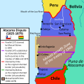 Atacama Desert Dispute between Bolivia and Chile (1825 - 1879).svg 1,500 × 1,500; 3.41 MB
-
 Desierto de Atacama en la Carta esférica de las costas del Reyno de Chile (1799).jpg 1,172 × 2,316; 1.67 MB
-
 Disputa limítrofe del desierto de Atacama entre Bolivia y Chile (1825 - 1879).svg 1,500 × 1,500; 3.5 MB
-

-
 Mediterraneidad de Bolivia.jpg 1,141 × 1,141; 136 KB
-
 War of the Pacific LOC map.svg 445 × 584; 166 KB
.jpg)
.svg)
.jpg)
.svg)
_(Editado).jpg)

