Category:Maps of the Armenia-Azerbaijan border
Jump to navigation
Jump to search
Media in category "Maps of the Armenia-Azerbaijan border"
The following 9 files are in this category, out of 9 total.
-
 2020 Artsakh ceasefire map de.svg 757 × 828; 324 KB
-
 2021 Armenia-Azerbaijan Border Clashes.svg 2,430 × 2,948; 6.92 MB
-
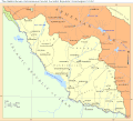 265nakhichevan-assr.gif 700 × 633; 49 KB
-
 Armenia-Azerbaijan Border Crisis.svg 2,430 × 2,948; 7.01 MB
-
 Azerbaijan-Armenia state border.png 2,589 × 1,741; 272 KB
-
 Map of Azerbaijani strikes on the territory of Armenia between 12-13 September 2022.png 2,047 × 1,375; 317 KB
-
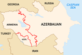
 Occupied territories of Armenia and Azerbaijan in the northwest.png 3,842 × 2,160; 3.63 MB
-
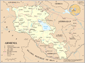 Un-armenia.png 3,038 × 2,257; 1.38 MB
-
 Տավուշի հայ-ադրբեջանական սահմանամերձ բնակավայրեր.png 4,321 × 3,065; 184 KB


