Category:Maps of the American Civil War
Jump to navigation
Jump to search
Subcategories
This category has the following 39 subcategories, out of 39 total.
Media in category "Maps of the American Civil War"
The following 200 files are in this category, out of 358 total.
(previous page) (next page)-
"An American Turning Point- The Civil War in Virginia (16864672811).jpg 4,226 × 2,592; 4.1 MB
-
1860-61 Secession in Appalachia by County.jpg 1,887 × 2,393; 1.82 MB
-
CRAFTS (1868) p1.674 FORT PULASKI.jpg 1,345 × 985; 903 KB
-
1Yorktown1862 rus.gif 1,268 × 1,006; 58 KB
-
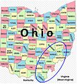
2nd WV Cavalry and Ohio Counties for Recruits.JPG 550 × 608; 94 KB
-
351 of 'The Youth's History of the United States, etc' (11190315526).jpg 2,928 × 1,512; 758 KB
-
447 of 'Cassell's History of the United States ... Illustrated' (11105482803).jpg 1,958 × 1,543; 529 KB
-
458 of 'A History of the United States of America, etc' (11248036114).jpg 1,265 × 2,028; 920 KB
-
Abolition of slavery in the United States SVG map.svg 942 × 595; 183 KB
-
Abraham Lincoln and the battles of the Civil War (1887) (14782618353).jpg 2,114 × 3,156; 1.47 MB
-
Across Kentucky LOC 99446408.jpg 5,122 × 6,625; 3.4 MB
-
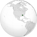
Alabama (1861) orthographic.svg 551 × 551; 2.31 MB
-
American Civil War - map.jpg 1,075 × 735; 151 KB
-
Antietam Sharpsburg and Vicinity - NARA - 137929259.jpg 2,776 × 3,736; 611 KB
-
Arizona Civil War New Mexico.png 422 × 359; 24 KB
-
Atlanta Campaign May7-Jul2.png 1,900 × 3,250; 1.18 MB
-
Atlanta campaign-1864. "Rossville" to "Snake Creek Gap." LOC 99446380.jpg 5,090 × 6,509; 3.61 MB
-
Battle map of 2nd Bull Run.jpg 5,417 × 4,790; 6.54 MB
-
Battle map of Corinth.jpg 3,631 × 6,411; 4.3 MB
-
Battle of Big Black River Bridge map.jpg 1,600 × 1,527; 642 KB
-
Battle of Fredericksburg map.jpg 918 × 1,494; 217 KB
-
Battle of Gettysburg map.jpg 902 × 1,480; 213 KB
-
Battle of Hendersons Hill Map.jpg 763 × 678; 338 KB
-
Battle of Iuka - History of Iowa.jpg 908 × 747; 115 KB
-
Battle of Iuka.png 1,851 × 1,528; 524 KB
-
Battle of Pea Ridge 2.png 2,032 × 1,490; 1.72 MB
-
Battle of Pea Ridge 3.png 2,083 × 1,482; 1.9 MB
-
Battle of Roanoke Island. American Civil War.jpg 438 × 584; 52 KB
-
Battle of Scary Creek map.jpg 926 × 913; 114 KB
-
Battle of Shiloh battle map, 1865.jpg 2,727 × 2,211; 1.27 MB
-
Battle of Shiloh map.jpg 913 × 1,504; 297 KB
-
Battle of Stones River map.jpg 891 × 769; 145 KB
-
Battlefield in front of Franklin Tenn. - DPLA - 5b5452cf944474344ac3600ab69c73de.jpg 7,898 × 8,967; 8.4 MB
-
Battle of Bayou Forche map.png 800 × 1,938; 994 KB
-
Big Sandy Expedition cropped.jpg 266 × 315; 29 KB
-
Big Sandy Expedition.pdf 1,275 × 1,650; 91 KB
-
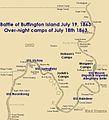
Buffington-battle-map.jpg 709 × 779; 77 KB
-
CalColumnMap.jpg 931 × 503; 142 KB
-
Campagne de Shiloh (1861-1862).jpg 1,011 × 449; 264 KB
-
Campagne de Shiloh.png 1,024 × 756; 1,023 KB
-
Campagne du Bas-Mississippi.jpg 1,327 × 1,071; 179 KB
-
Campanha do Vale de Jackson- Front Royal para Port Republic..png 400 × 450; 375 KB
-
Capture of Fort Donelson map.jpg 1,732 × 1,548; 613 KB
-
Carte de la Chute de Petersburg.png 400 × 313; 125 KB
-
Chart of Civil War torpedo victims near Charleston SC.jpg 680 × 675; 147 KB
-
Chattanooga Tenn. 1863 LOC 2003630438.jpg 5,024 × 6,383; 4.06 MB
-
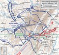
Chickamauga Campaign August-September 1863.pdf 1,200 × 1,125; 3.85 MB
-
Chimborazo hospital richmond civil war position.png 750 × 844; 521 KB
-
Civil war battlefield maps - nashville and franklin 1895.jpg 10,056 × 6,183; 19.72 MB
-
Civil War Map - Federal Union and Southern States.png 726 × 471; 336 KB
-
Civilwar alabama.jpg 605 × 744; 143 KB
-
Colton's map of Virginia, Maryland & Delaware2.jpg 4,001 × 3,043; 3.98 MB
-
Colton's United States shewing the military stations, forts, &c LOC 99447014.jpg 5,551 × 4,822; 5.82 MB
-
Confederate Military History - 1899 - Volume 3 (page 112+113).jpg 2,478 × 2,923; 4.59 MB
-
Confederate Military History - 1899 - Volume 3 (page 155 crop).jpg 1,589 × 1,342; 1.05 MB
-
Confederate Military History - 1899 - Volume 3 (page 261 crop).jpg 1,532 × 2,380; 2.14 MB
-
Confederate Military History - 1899 - Volume 3 (page 311 crop).jpg 1,475 × 1,923; 1.37 MB
-
Confederate Military History - 1899 - Volume 3 (page 346 crop).jpg 2,029 × 1,500; 1.87 MB
-
Copy of C.H. Webber's Map of a Scout made by Colonel Nevin. - NARA - 103396424 (page 1).jpg 7,832 × 4,768; 2.07 MB
-
Copy of C.H. Webber's Map of a Scout made by Colonel Nevin. - NARA - 103396424 (page 2).jpg 7,824 × 4,953; 1.99 MB
-
Copy of Capt. J.G. Keney's Map of Owen's River Valley and Vicinity - NARA - 93193147.jpg 2,700 × 4,023; 583 KB
-
Cox map of Marietta operations.jpg 732 × 542; 94 KB
-
Custer at Dinwiddie Court House.JPG 580 × 317; 60 KB
-
Defense of Fort Morgan, Alabama - NARA - 122206888.jpg 5,752 × 4,618; 1.42 MB
-
Defense of Salem and Marblehead Harbor Map - NARA - 50926288.jpg 9,472 × 8,244; 7.37 MB
-
Dover, February 15, 1862 (13147922554).jpg 2,341 × 2,224; 1.62 MB
-
Engagement in Albemarle Sound map.jpg 1,579 × 1,199; 530 KB
-
Engagement of the Union and Rebel Gunboats near Fort Wright, May 10 1862.jpg 3,840 × 3,342; 2.77 MB
-
Ferrero's Brigade at Second Bull Run.jpg 494 × 434; 99 KB
-
First Bull Run (Manassas) Campaign.png 2,090 × 2,289; 2.11 MB
-
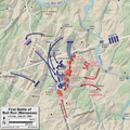
First Bull Run (Manassas) July 21 1000.png 3,150 × 2,250; 10.21 MB
-
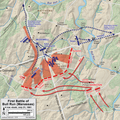
First Bull Run (Manassas) July 21 1300.png 2,400 × 2,400; 4.79 MB
-
First Bull Run (Manassas) July 21 1600.png 2,400 × 2,400; 4.91 MB
-
Flag map of the United States 34 stars,.png 1,652 × 1,035; 158 KB
-
Florida (1861) orthographic.svg 551 × 551; 2.3 MB
-
Forbes' new and complete map of Richmond and its fortifications (14004921092).jpg 1,499 × 2,000; 3.23 MB
-
Fort Pillow State Park TN 09 museum map Defense of the Mississippi.jpg 1,024 × 1,365; 912 KB
-
Franklin-Tenn. profield (sic) June 1863 LOC 2003630448.jpg 6,067 × 4,764; 2.73 MB
-
From Mitchelsville (sic) to Gallatin-Sumner Co., Tenn., 1862 LOC 2003630474.jpg 6,104 × 4,618; 3.82 MB
-
From the Etowah to Burnt-Hickory, Ga. LOC 99446381.jpg 4,654 × 6,127; 2.6 MB
-
G3972 M6 1864 U5 (17790276066).jpg 5,557 × 5,485; 2.93 MB
-
G3984 V8S5 1863 W7 (17178564620).jpg 6,552 × 5,024; 8.15 MB
-
Georgia (1861) orthographic.svg 551 × 551; 2.31 MB
-
Glorieta Pass.png 3,264 × 2,448; 8.06 MB
-
Grant's Campaign - Topographical Map of Virginia - Harper's Weekly May 28 1864.jpg 2,256 × 3,317; 3.34 MB
-
GrantPlanSWVA1864May.png 787 × 737; 1.11 MB
-
Historical sketch of the Rebellion (1864) - NARA - 86455624.jpg 5,728 × 6,431; 2.5 MB
-
Historical Sketch of the Rebellion - NARA - 86455593.jpg 5,888 × 7,040; 3.04 MB
-
History of the American Civil War (1873) (14576101630).jpg 1,524 × 2,536; 501 KB
-
Hood Campaign Florence to Columbia.png 1,956 × 2,445; 846 KB
-
Iuka-Corinth Campaign1.png 3,300 × 2,550; 2.5 MB
-
Iuka-Corinth Campaign2.png 3,300 × 2,550; 2.78 MB
-
IXCorps 16850402 0400-16850402 0500.jpg 1,400 × 1,082; 660 KB
-
IXCorps 16850402 0500-16850402 1200.jpg 1,400 × 1,082; 647 KB
-
IXCorps 16850402 1200-16850403 2400.jpg 1,400 × 1,082; 627 KB
-
IXCorps 16850402 2000-16850403 0430.jpg 1,400 × 1,089; 617 KB
-
IXCorps 16850402 Pre-Dawn.jpg 1,400 × 1,082; 654 KB
-
Jackson's Valley Campaign May 21 - June 9, 1862.png 2,209 × 1,889; 2.81 MB
-
Kennesawmt.svg 744 × 1,052; 82 KB
-
Kilpatrick Pursues.png 676 × 524; 47 KB
-
Knoxville Campaign Area 1863.png 2,401 × 2,077; 3.82 MB
-
Knoxville Walkers Ford.png 2,401 × 2,077; 5.75 MB
-
Lafourche Campaign Oct 1862.jpg 812 × 460; 177 KB
-
Lightburns Retreat September 1862.JPG 585 × 620; 99 KB
-
List of maps of Battlefields of the Late War -Civil War- - NARA - 135841226 (page 1).jpg 8,280 × 6,814; 2.35 MB
-
List of maps of Battlefields of the Late War -Civil War- - NARA - 135841226 (page 10).jpg 8,364 × 6,858; 5.74 MB
-
List of maps of Battlefields of the Late War -Civil War- - NARA - 135841226 (page 12).jpg 8,312 × 6,856; 2.06 MB
-
List of maps of Battlefields of the Late War -Civil War- - NARA - 135841226 (page 2).jpg 8,308 × 6,911; 2.15 MB
-
List of maps of Battlefields of the Late War -Civil War- - NARA - 135841226 (page 3).jpg 8,284 × 6,822; 5.57 MB
-
List of maps of Battlefields of the Late War -Civil War- - NARA - 135841226 (page 4).jpg 8,324 × 6,832; 1.89 MB
-
List of maps of Battlefields of the Late War -Civil War- - NARA - 135841226 (page 5).jpg 8,360 × 6,847; 1.98 MB
-
List of maps of Battlefields of the Late War -Civil War- - NARA - 135841226 (page 6).jpg 8,280 × 6,865; 2.02 MB
-
List of maps of Battlefields of the Late War -Civil War- - NARA - 135841226 (page 7).jpg 8,348 × 6,826; 5.54 MB
-
List of maps of Battlefields of the Late War -Civil War- - NARA - 135841226 (page 8).jpg 8,348 × 6,858; 2.09 MB
-
List of maps of Battlefields of the Late War -Civil War- - NARA - 135841226 (page 9).jpg 8,348 × 6,863; 5.42 MB
-
Longstreets Knoxville Campaign.png 1,558 × 1,658; 337 KB
-
Louisiana (1861) orthographic.svg 551 × 551; 2.31 MB
-
Lower Mississippi River Map.jpg 5,600 × 3,090; 5.81 MB


