Category:Maps of the American Battlefield Protection Program Kentucky
Jump to navigation
Jump to search

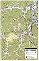
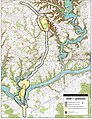
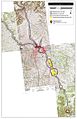
The American Battlefield Protection Program (ABPP) is a US federal government program implemented by the National Park Service of the Department of the Interior with the aim of preserving historic battlefields in the United States. Maps of in this category display battlefield core and study areas, existing and potential national register boundaries.
Media in category "Maps of the American Battlefield Protection Program Kentucky"
The following 8 files are in this category, out of 8 total.
-
 Barbourville Battlefield Kentucky.jpg 1,180 × 910; 646 KB
-
 Belmont Battlefield Missouri.jpg 1,600 × 1,210; 555 KB
-
 Camp Wildcat Battlefield Kentucky.jpg 1,010 × 1,320; 790 KB
-
 Middle Creek Battlefield Kentucky.jpg 850 × 1,330; 841 KB
-
 Mill Springs Battlefield Kentucky.jpg 1,040 × 1,350; 864 KB
-
 Paducah Battlefield Kentucky.jpg 880 × 1,150; 647 KB
-
 Richmond Battlefield Kentucky.jpg 900 × 1,395; 475 KB
-
 Rowlett's Station Battlefield Kentucky.jpg 930 × 1,200; 694 KB


