Category:Maps of the American Battlefield Protection Program Kansas
Jump to navigation
Jump to search

The American Battlefield Protection Program (ABPP) is a US federal government program implemented by the National Park Service of the Department of the Interior with the aim of preserving historic battlefields in the United States. Maps of in this category display battlefield core and study areas, existing and potential national register boundaries.
Media in category "Maps of the American Battlefield Protection Program Kansas"
The following 4 files are in this category, out of 4 total.
-
 Baxter Springs Battlefield Kansas.jpg 1,650 × 1,270; 419 KB
-
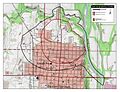
 Lawrence Battlefield Kansas.jpg 1,200 × 1,580; 726 KB
-
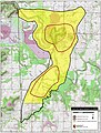 Marais des Cygnes Battlefield Kansas.jpg 1,200 × 1,580; 724 KB
-
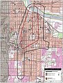
 Mine Creek Battlefield Kansas.jpg 1,210 × 1,580; 738 KB


