Category:Maps of the 2019 Danish general election
Jump to navigation
Jump to search
Media in category "Maps of the 2019 Danish general election"
The following 8 files are in this category, out of 8 total.
-
 Folketing2019.svg 2,834 × 2,126; 5.57 MB
-
 Folketingsvalget 2019 - Afstemningsområder.svg 510 × 412; 3.76 MB
-
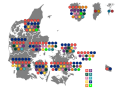
 Folketingsvalget 2019 - fordelingen af kredsmandater.svg 510 × 412; 1.45 MB
-
 Folketingsvalget 2019 - Opstillingskredse (Blokke).svg 510 × 412; 2.33 MB
-
 Folketingsvalget 2019 - Opstillingskredse.svg 510 × 412; 2.3 MB
-
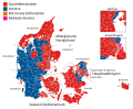
 Wahlkarte Folketing Dänemark 2019 da.svg 956 × 784; 1.94 MB
-
 Wahlkarte Folketing Dänemark 2019.svg 956 × 784; 1.92 MB
-
 Wahlkarte2 Folketing Dänemark 2019.svg 1,015 × 686; 1.06 MB


.svg)


