Category:Maps of the 1948 Arab Israeli War
Jump to navigation
Jump to search
Wikimedia category | |||||
| Upload media | |||||
| Instance of | |||||
|---|---|---|---|---|---|
| |||||
| Category Maps of the 1948 Arab Israeli War on sister projects: | |||||||||
|---|---|---|---|---|---|---|---|---|---|
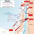
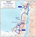
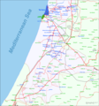
English: Maps of the 1948 Arab-Israeli War.
See also:
Subcategories
This category has only the following subcategory.
Media in category "Maps of the 1948 Arab Israeli War"
The following 98 files are in this category, out of 98 total.
-
1947-UN-Partition-Plan-1949-Armistice-Comparison-ar.png 367 × 1,029; 56 KB
-
1947-UN-Partition-Plan-1949-Armistice-Comparison-ar.svg 500 × 1,029; 29 KB
-
1947-UN-Partition-Plan-1949-Armistice-Comparison-es.svg 500 × 1,029; 33 KB
-
1947-UN-Partition-Plan-1949-Armistice-Comparison-hu.svg 500 × 1,029; 33 KB
-
1947-UN-Partition-Plan-1949-Armistice-Comparison-it.svg 500 × 1,029; 33 KB
-
1947-UN-Partition-Plan-1949-Armistice-Comparison.png 367 × 1,029; 26 KB
-
1947-UN-Partition-Plan-1949-Armistice-Comparison.svg 367 × 1,029; 48 KB
-
1948 arab israeli war - Dec22-Jan07.jpg 736 × 901; 102 KB
-
1948 Arab Israeli War - May 15-June 10 de.svg 904 × 884; 344 KB
-
1948 Arab Israeli War - May 15-June 10-ar.svg 2,345 × 2,293; 1.72 MB
-
1948 Arab Israeli War - May 15-June 10-es.svg 904 × 884; 922 KB
-
1948 Arab Israeli War - May 15-June 10.svg 904 × 884; 454 KB
-
1948 Arab Israeli War - May 15-June 10.svg fr.png 2,094 × 2,048; 1,000 KB
-
1948 Arab Israeli War - May 15-June he.svg 904 × 884; 865 KB
-
1948 arab israeli war - May15-June10.jpg 898 × 903; 143 KB
-
1948 arab israeli war - Oct - GER.jpg 898 × 903; 153 KB
-
1948 arab israeli war - Oct.jpg 898 × 903; 130 KB
-
1948 arab israeli war May15-June10 ru.jpg 898 × 903; 218 KB
-
1948 war Israeli line July 15-16 1948.png 1,442 × 1,324; 163 KB
-
1948 war July 16-17 1948.png 1,436 × 1,321; 170 KB
-
1948 war July 17-18 1948.png 1,207 × 707; 88 KB
-
1948-arab-israeli-war-Dec22-jan07-detail.jpg 700 × 486; 76 KB
-
Arab-Israeli War 1948-hu.svg 904 × 884; 373 KB
-
AshkelonBtl191048.jpg 956 × 1,416; 303 KB
-
Battle of Bait Daras.jpg 2,048 × 1,536; 723 KB
-
Ben'Ami.GIF 236 × 193; 6 KB
-
BtlTLV4648.jpg 1,115 × 1,707; 227 KB
-
Danny-lydda-ramle-front.png 894 × 1,379; 170 KB
-
Danny-lydda-ramle-front2.png 1,852 × 1,989; 343 KB
-
DeadSeaEnGdi1949.jpg 826 × 1,253; 192 KB
-
Debut-octobre-1948.jpg 500 × 880; 75 KB
-
DeirYassinWiki.jpg 935 × 824; 253 KB
-
Green Line - Cease Fire Agreement 30 Nov 1948.jpg 3,119 × 8,630; 7.33 MB
-
Gush Etzion.GIF 357 × 187; 8 KB
-
Independencewarmap.JPG 331 × 715; 31 KB
-
IsEgptBtl1149.jpg 1,110 × 1,671; 237 KB
-
Israel 15 mai 1948-ar.jpg 357 × 567; 79 KB
-
Israel 15 mai 1948-b-ar.jpg 357 × 567; 75 KB
-
Israel 15 mai 1948.GIF 357 × 567; 17 KB
-
Israel 20 mai 1948.GIF 357 × 567; 17 KB
-
Israel and Palestine 1st June 1948-ar.svg 1,240 × 2,240; 1.25 MB
-
Israel and Palestine 1st June 1948-EN.svg 595 × 1,075; 731 KB
-
Israel and Palestine 1st June 1948-FR.svg 595 × 1,075; 731 KB
-
Israel and Palestine 1st June 1948-ZH.svg 595 × 1,075; 241 KB
-
Israel-1947-1949.jpg 500 × 880; 29 KB
-
Israel-1er-juin-1948-bis.png 600 × 1,056; 89 KB
-
Israel-1er-juin-1948-detail-galilee.png 450 × 293; 101 KB
-
Israel-1er-juin-1948-detail-sud.png 413 × 359; 71 KB
-
Israel-1er-juin-1948-detail-tiberiade.png 350 × 540; 138 KB
-
Israel-1er-juin-1948.jpg 600 × 1,056; 97 KB
-
ISRAEL-AL-TANTOURA-operation-namal.png 357 × 567; 21 KB
-
ISRAEL-AL-TANTOURA-operation-namal2.png 357 × 567; 45 KB
-
Israel-octobre-1948-detail-nord.png 450 × 228; 82 KB
-
Israeli War of Independence - October Battles - Hebrew.jpg 1,786 × 1,758; 584 KB
-
Israeli War of Independence - Operation Horev - Hebrew.jpg 932 × 1,129; 306 KB
-
Jerusalem1947 fr.png 677 × 681; 85 KB
-
Jerusalem1947.png 677 × 681; 51 KB
-
Jewish zones 12147.PNG 358 × 564; 28 KB
-
Jewish zones 1947.jpg 684 × 1,396; 19 KB
-
Kinarot valley degania.png 868 × 828; 200 KB
-
Kinarot valley firstbattle.png 732 × 698; 202 KB
-
Kinarot valley topo.png 698 × 665; 73 KB
-
Kinarot valley tzemah.png 732 × 698; 197 KB
-
Kinarot valley.png 732 × 698; 114 KB
-
Latroun (10 mai)-ar.png 1,114 × 720; 186 KB
-
Latroun (10 mai).png 1,114 × 720; 253 KB
-
Latroun (15 mai)-ar.png 1,114 × 720; 208 KB
-
Latroun (15 mai).png 1,114 × 720; 339 KB
-
Lydda and Ramla area - 9 July 1948.PNG 823 × 1,263; 92 KB
-
Map of IDF units in May 15, 1948.jpg 1,138 × 1,600; 181 KB
-
MedArenaIndWar.jpg 1,024 × 768; 177 KB
-
Nachshon.GIF 357 × 159; 7 KB
-
Nitzanim orientation.png 1,324 × 1,328; 267 KB
-
Operation Ha-Har.jpg 1,006 × 383; 823 KB
-
Operation-Pleshet-map1.png 900 × 1,020; 152 KB
-
OperationGys1.png 1,436 × 896; 106 KB
-
Ordre de bataille Palestine avril 48.gif 357 × 567; 18 KB
-
Ouvda-mars-1949 - he.png 794 × 1,362; 162 KB
-
Ouvda-mars-1949 deutsch.png 798 × 1,340; 257 KB
-
Ouvda-mars-1949 english.png 798 × 1,340; 255 KB
-
Ouvda-mars-1949.png 798 × 1,340; 293 KB
-
Palestine Military Situation, April 6, 1949, Truman Papers.jpg 685 × 1,285; 170 KB
-
Palestine Military Situation, June 11, 1948, Truman Papers.jpg 685 × 902; 160 KB
-
Palestine War from July 18.jpg 550 × 960; 214 KB
-
PikiWiki Israel 10245 outpost ibdis (independence war).jpg 2,048 × 1,536; 678 KB
-
Shapiro War map no5 1948 30x46cm.jpg 1,776 × 2,724; 1.23 MB
-
United Nations General Assembly Resolution 181 boundaries.jpg 2,828 × 8,208; 18.87 MB
-
Yiftah.GIF 357 × 195; 7 KB
-
Zones controlled by Yishuv by the 20may48 ger.GIF 357 × 567; 24 KB
-
Zones controlled by Yishuv by the 20may48.GIF 357 × 567; 24 KB
-
Zones juives 1dec47 + relief.GIF 357 × 567; 18 KB
-
Zones juives 1dec47 + relief.svg 446 × 709; 419 KB
-
מפת הנסיגה 2021.png 4,129 × 4,436; 161 KB
-
מפת מסע מחלקת הל""ה.svg 906 × 455; 1.7 MB
-
מפת מסע מחלקת הל"ה.svg 906 × 455; 1.72 MB


