Category:Maps of territorial waters of Venezuela
Jump to navigation
Jump to search
Media in category "Maps of territorial waters of Venezuela"
The following 8 files are in this category, out of 8 total.
-
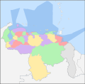
Administracion politica territorial.png 614 × 599; 76 KB
-
Diferendo Golfo de Venezuela.svg 1,030 × 919; 34 KB
-
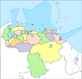
Localizador Politico de Venezuela.svg 534 × 614; 145 KB
-
Localizador Politico Venezuela.svg 623 × 612; 148 KB
-
Límites marítimos de Venezuela.png 732 × 558; 22 KB
-
VE-Dependencias Federales ubicacion.png 3,934 × 2,048; 1.36 MB
-
Venezuela Political Locator.svg 623 × 598; 170 KB
-
Venezuelamapaconfrenteatlantico.jpg 2,550 × 2,516; 176 KB


