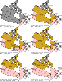
Category:Maps of territorial evolution of Canada
Jump to navigation
Jump to search
Countries of the Americas: Canada · United States of America
Media in category "Maps of territorial evolution of Canada"
The following 8 files are in this category, out of 8 total.
-
Canada provinces evolution - ru.gif 1,000 × 864; 310 KB
-
Canada provinces evolution 2.gif 1,000 × 864; 243 KB
-
Canada provinces evolution-250.gif 250 × 216; 211 KB
-
Canada provinces evolution.gif 1,000 × 864; 247 KB
-
Canadà - Territòri canadenc en 1867.png 998 × 780; 294 KB
-
Canadà - Territòri canadenc en 1905.png 1,001 × 779; 346 KB
-
Province of Quebec 1763, 1774, 1784.gif 1,445 × 1,058; 158 KB
-
Évolution territoriale du Bas-Canada.gif 1,445 × 1,058; 192 KB


