Category:Maps of subdivisions of the Viceroyalty of Peru
Jump to navigation
Jump to search
Media in category "Maps of subdivisions of the Viceroyalty of Peru"
The following 7 files are in this category, out of 7 total.
-
 Audencias of Viceroyalty of Peru.PNG 766 × 1,003; 168 KB
-

-
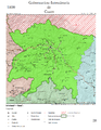
 Intendencia de Huancavelica.png 2,550 × 3,300; 5.04 MB
-
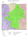
 Intendencia-1800-28.png 2,550 × 3,300; 4.58 MB
-
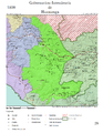 Intendencia-1800-29.png 2,550 × 3,300; 5.05 MB
-
 Partidos de la intendencia de tarma.png 996 × 673; 75 KB
-
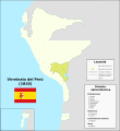 Virreinato del Perú (1810).svg 1,949 × 2,126; 7.45 MB


.svg)