Category:Maps of subdivisions of Uganda
Jump to navigation
Jump to search
Countries of Africa: Algeria · Benin · Botswana · Burkina Faso · Cameroon · Cape Verde · Chad · Republic of the Congo · Equatorial Guinea · Ethiopia · Gabon · Ghana · Guinea · Ivory Coast · Kenya · Lesotho · Liberia · Madagascar · Morocco · Mozambique · Namibia · Niger · Rwanda · Sierra Leone · Somalia · South Africa · South Sudan · Sudan · Tanzania · Togo · Uganda · Zambia · Zimbabwe
Limited recognition: Ambazonia
Limited recognition: Ambazonia
Subcategories
This category has the following 2 subcategories, out of 2 total.
M
Media in category "Maps of subdivisions of Uganda"
The following 10 files are in this category, out of 10 total.
-
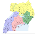
 Uganda counties.png 1,601 × 1,027; 42 KB
-
 Uganda districts 2010.png 1,046 × 1,100; 887 KB
-
 Uganda districts nov 2020.png 943 × 908; 363 KB
-
 Uganda Distrikt Kasese.svg 1,342 × 1,361; 318 KB
-
 Uganda Distrikte 45.svg 550 × 600; 722 KB
-
 Uganda Distrikte 56.svg 550 × 600; 759 KB
-
 Uganda Physiography.jpg 1,999 × 2,464; 1.42 MB
-
 Uganda sub-counties.png 1,601 × 1,027; 63 KB
-
 Uganda Transportation.jpg 2,004 × 2,438; 1.25 MB
-
 Ugandesenewdivisions.jpg 653 × 740; 59 KB


