Category:Maps of shield volcanoes
Jump to navigation
Jump to search
Media in category "Maps of shield volcanoes"
The following 6 files are in this category, out of 6 total.
-
 Easter Island map-en.svg 1,750 × 1,245; 878 KB
-
 Itcha Range geology.png 571 × 370; 66 KB
-
 Kampu Volcano Relief Map, SRTM-1.jpg 800 × 600; 290 KB
-
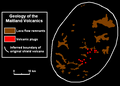 Maitland Volcanics.png 567 × 407; 16 KB
-
 Piton Fournaise topo map-fr.svg 1,000 × 1,166; 461 KB
-
 Structure of Level Mountain.png 414 × 298; 10 KB


