Category:Maps of sedimentary basins
Appearance
Deutsch: Karten von Sedimentbecken
· English: Sedimentary basins maps
· Français : Cartes des bassins sédimentaires
· Italiano: Carte di bacini sedimentari
· - Put maps of drainage basins and structural basins in their relative categories
Subcategories
This category has the following 4 subcategories, out of 4 total.
Media in category "Maps of sedimentary basins"
The following 140 files are in this category, out of 140 total.
-
USGS world oil endowment.png 1,047 × 551; 33 KB
-
Weltkarte konventionelle Öl u. -Gasförderung.png 2,000 × 1,086; 1.12 MB
-
Weltkarte unkonventionelle Öl- u. Gaslagerstätten.png 2,000 × 1,085; 1.3 MB
-
World geologic provinces.jpg 1,200 × 637; 115 KB
-
ArcticLocationMap2.png 525 × 488; 75 KB
-
The Resource Basin in the Arctic Circle .jpg 394 × 300; 140 KB
-
Regiones petroleras - Sudamérica.svg 579 × 762; 300 KB
-
South America satellite plane Bacia do Parana es.jpg 420 × 605; 31 KB
-
South America satellite plane Bacia do Parana.jpg 422 × 605; 30 KB
-
Basin subdivision of the Adelaide Superbasin.svg 512 × 355; 101 KB
-
Extent map of the Adelaide Superbasin.svg 512 × 731; 4.8 MB
-
West African Basins.svg 614 × 468; 100 KB
-
Altiplano basin1.JPG 648 × 798; 138 KB
-
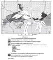
Animikie Group and Marquette Range and Huronian supergroups.PNG 386 × 436; 59 KB
-
Animikie Group, Marquette Range and Huronian supergroups2.PNG 692 × 776; 183 KB
-
Ross Sea Antarctica sea floor geology.svg 464 × 369; 231 KB
-
Area for basin.jpg 669 × 477; 161 KB
-
Area of basin.jpg 669 × 477; 125 KB
-
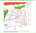
Geological-summary-map-Barito Basin.jpg 529 × 750; 117 KB
-
Bassin sénégalo-mauritano-guinéen.jpg 1,415 × 3,238; 814 KB
-
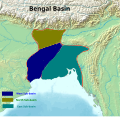
Bengal Basin Location on Map.png 371 × 358; 215 KB
-
Bengal Basin.png 618 × 600; 592 KB
-
Bengal Basin.svg 1,005 × 975; 1,011 KB
-
Bermejo Valley geological map.png 2,007 × 1,543; 2.55 MB
-
Mapa geologico do Rio Grande do Sul - Brasil.JPG 697 × 520; 41 KB
-
Broad Fourteens Basin map NL.svg 491 × 420; 1.67 MB
-
Broad Fourteens Basin map.png 867 × 742; 141 KB
-
Sedimentary basins in Nova Scotia.png 1,543 × 845; 1.15 MB
-
Candelária Formation - Map.jpg 1,232 × 780; 434 KB
-
Candelária Sequence - Paraná Basin, Brazil.jpg 1,695 × 765; 415 KB
-
Carte du Maroc-01.png 1,622 × 1,764; 712 KB
-
Cañadón Asfalto formation.png 2,050 × 1,602; 1.78 MB
-
China edcp relief location map Sichuan.png 1,968 × 1,567; 6.62 MB
-
China srtm 2008133 lrg.jpg 1,200 × 1,200; 1.91 MB
-
Cooper Basin Geological Map.png 655 × 606; 580 KB
-
НГП СНГ и Балтики.png 3,540 × 1,453; 528 KB
-
Delaware Basin map.PNG 1,160 × 734; 123 KB
-
Early Toarcian Europe Map.png 850 × 688; 374 KB
-
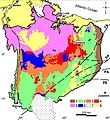
EIA Neuquen Basin.png 863 × 888; 953 KB
-
EBloc.jpg 272 × 354; 22 KB
-
Exudações de óleo na Bacia do Paraná no estado de São Paulo.jpg 472 × 678; 45 KB
-
Francevillian basin geology.png 1,104 × 1,240; 352 KB
-
Geologic map of the Parnaíba Basin.jpg 768 × 839; 356 KB
-
Geologic map SE England & Channel EN.svg 1,374 × 890; 1.65 MB
-
Geologic map SE England & NW France BR.svg 1,374 × 890; 1.44 MB
-
Geologic map SE England & NW France FR.svg 1,374 × 890; 1.44 MB
-
Geological map Central Morocco - Herbig 1991.png 3,899 × 2,513; 236 KB
-
Geological Map Hampshire Basin Chatwin.jpg 3,242 × 2,874; 721 KB
-
Geology around basin.png 913 × 647; 184 KB
-
Grand Daoui - Gheerbrant et al 2003.png 3,870 × 2,016; 73 KB
-
Graupensandrinne Hegau Schwäbische Alb1.jpg 1,800 × 1,200; 635 KB
-
Graupensandrinne Hegau Schwäbische Alb2.jpg 1,800 × 1,200; 517 KB
-
НГБ Гвинейского залива.png 2,254 × 1,507; 471 KB
-
Geological map of Hampshire Basin.jpg 714 × 361; 42 KB
-
Himalayan foreland basin.png 3,389 × 1,966; 5.91 MB
-
Iberian mesozoic sedimentary basins EN.svg 542 × 413; 171 KB
-
Cuencas sedimentarias cenozoicas ibéricas.svg 542 × 406; 108 KB
-
Iberian mesozoic sedimentary basins ES.svg 542 × 413; 171 KB
-
Ischigualasto Formation map and stratigraphy.png 2,012 × 2,400; 3.87 MB
-
Ischigualasto-Villa Unión Basin Map detail.png 2,146 × 2,892; 1.22 MB
-
Itaboraí Basin.png 2,283 × 1,441; 1.15 MB
-
Iullemmeden Basin.svg 231 × 231; 37 KB
-
Jeanne dArc Basin.jpg 820 × 521; 58 KB
-
Location of junggar basin.svg 512 × 408; 2.34 MB
-
Kalimantan-geomap.jpg 382 × 600; 64 KB
-
Нефтегазоносные провинции Казахстана.png 2,448 × 1,542; 542 KB
-
Borneo Topography Kutai basin.png 1,725 × 1,824; 2.53 MB
-
Kutai Basin.png 1,642 × 897; 2.31 MB
-
Кванза-Камерунский НГБ.png 1,708 × 3,157; 512 KB
-
Geological map of London Basin.jpg 570 × 518; 221 KB
-
LA Basin.jpg 679 × 600; 213 KB
-
Lübecker Becken.jpg 1,723 × 1,081; 2.07 MB
-
Map of Parnaíba Basin and surrounding areas.jpg 1,077 × 841; 516 KB
-
Map of the Cooper Basin.jpg 2,433 × 2,528; 1.15 MB
-
Mesozoic to Cenozoic of Junggar Basin(2).gif 1,100 × 775; 210 KB
-
Mesozoic to Cenozoic of Junggar Basin.gif 1,100 × 767; 240 KB
-
Michigan Basin 2.jpg 357 × 360; 47 KB
-
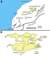
Oulad Abdoun Basin (borderless).png 2,492 × 2,889; 1.46 MB
-
Oulad Abdoun Basin.png 2,600 × 2,990; 1.58 MB
-
Niger Delta Basin Location.png 575 × 342; 212 KB
-
Nigerdeltapetroleumsys.gif 731 × 545; 60 KB
-
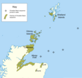
Orcadian Basin extent.png 1,609 × 1,548; 296 KB
-
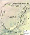
Ordos Block.png 1,912 × 2,218; 4.63 MB
-
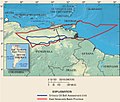
Orinoco USGS.jpg 719 × 611; 246 KB
-
Ouled Abdoun basin Yans et al 2014.png 3,380 × 2,483; 162 KB
-
Ouled-Abdoun - Bardet et al 2013 german.png 2,600 × 2,990; 1.04 MB
-
Owambo Basin.jpg 1,282 × 716; 90 KB
-
Owambo Map NASA Image.jpg 851 × 481; 55 KB
-
Palaeogeographic models Phosphate basins Morocco - Herbig 1991.png 5,573 × 4,761; 370 KB
-
Paradox basin map.png 943 × 1,151; 349 KB
-
Paranabecken.jpg 670 × 689; 97 KB
-
Geología de la Cuenca del Paraná.jpg 1,289 × 1,031; 438 KB
-
Mapa Geologia Bacia do Paraná simples.png 1,289 × 1,040; 1.24 MB
-
ParisBasin.jpg 2,172 × 2,074; 2.58 MB
-
Parnaiba1.png 1,153 × 713; 731 KB
-
Parnaíba Basin.png 948 × 937; 2.28 MB
-
Parnaíba Contexto.png 306 × 356; 78 KB
-
Parnaíba Estruturas.png 230 × 291; 55 KB
-
Parnaíba Limites Estruturais.png 519 × 290; 95 KB
-
Permian Basin.jpg 480 × 552; 86 KB
-
PermianBasin.png 1,275 × 892; 138 KB
-
Petroleum Distribution in Junggar Basin.png 3,225 × 1,789; 99 KB
-
Petroleum Distribution(2).png 3,225 × 1,852; 101 KB
-
Placement on craton.jpg 576 × 472; 41 KB
-
Qaidam location.png 380 × 300; 20 KB
-
River Lea basic geology.jpg 262 × 386; 71 KB
-
Russian Geologic Regions.svg 2,100 × 1,346; 5.37 MB
-
Tapuiasaurus location.png 2,049 × 1,555; 622 KB
-
НГП Сантоса.png 2,218 × 1,480; 639 KB
-
Santos basin map.png 990 × 609; 550 KB
-
Location of basin.png 655 × 410; 171 KB
-
Sichuan 2008 Aftershocks.jpg 630 × 825; 340 KB
-
Uitenhage Group Algoa Gamtoos map.png 2,784 × 1,504; 2.58 MB
-
South america geology andes.png 1,801 × 2,360; 563 KB
-
South Central US Sedimentary Basins.tif 2,657 × 3,106; 32.04 MB
-
Taoudeni Basin Map.gif 339 × 218; 3 KB
-
Tarakan-Geological-summary map.jpg 620 × 920; 143 KB
-
Topographic Map of the Cesar-Ranchería Basin - Colombia.jpg 1,429 × 788; 821 KB
-
Tremp Formation - units in the Tremp-Graus Basin.jpg 1,741 × 1,616; 1.3 MB
-
Tupi.jpg 1,836 × 1,836; 239 KB
-
Туркменские НГП.png 2,865 × 1,782; 652 KB
-
CZSedBasins.pdf 2,550 × 1,650; 2.3 MB
-
West Siberia structural map.png 490 × 769; 189 KB
-
USGS - Bazhenov Formation Oil Reservoir.png 1,150 × 1,325; 78 KB
-
PetroleumBasinsWA.png 700 × 1,008; 181 KB
-
Montney Formation.jpg 2,550 × 3,300; 1.19 MB
-
Canada geological map-WCSB.JPG 2,000 × 1,557; 2.07 MB
-
HYDROGEOLOGY AND WATER TABLE OF THE WILLAMETTE BASIN.pdf 4,502 × 5,020; 5.36 MB
-
Witwatersrand gold.png 736 × 579; 72 KB
-
Witwatersrand.jpg 308 × 279; 20 KB
-
Zementmergelschüsseln Schwäbische Alb.jpg 1,800 × 1,200; 1.14 MB
-
Zementmergelschüsseln+Flüsse Schwäbische Alb.jpg 1,800 × 1,431; 725 KB


