Category:Maps of salt mines in Saalekreis
Jump to navigation
Jump to search
Media in category "Maps of salt mines in Saalekreis"
The following 25 files are in this category, out of 25 total.
-
 5-Tiefbohrungen.png 1,130 × 305; 130 KB
-
 Absatz-Kaliwerk-Salzmünde.png 250 × 875; 32 KB
-
 Alle-4-Bergberechtsame.png 1,391 × 1,160; 557 KB
-
 Anlage-5.6.-Bild-2.jpg 1,000 × 1,559; 465 KB
-
 Brl.-u.-Schacht-neu.png 905 × 940; 606 KB
-
 Gebirgsschlagschäden.png 1,000 × 1,552; 437 KB
-
 Geologisch-räumliche Situation.png 1,294 × 764; 646 KB
-
 Gliederung-Kalilager.png 884 × 501; 46 KB
-
 Kaligrenzen.png 1,000 × 738; 88 KB
-
 Lage-GTS-TEU-2.png 2,000 × 1,179; 711 KB
-
 Lage-GTS-TEU.png 1,194 × 704; 963 KB
-
 Lageplan Schacht Adler.jpg 696 × 672; 257 KB
-
 Lageplan-Kurt.jpg 1,242 × 700; 407 KB
-
 Lageplan-Scht-H+S.png 1,313 × 666; 303 KB
-
 Lageplan-Wils.jpg 1,242 × 700; 401 KB
-
 Nachruf-TEU-1940.png 1,119 × 835; 340 KB
-
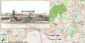
 OpenStreet-Salzmünde.png 1,008 × 787; 511 KB
-
 Preisstand-der-Salzmünder-K.png 651 × 689; 33 KB
-
 Regionalgeologie.png 1,200 × 658; 99 KB
-
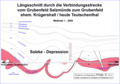 Salzke-Depression.png 1,755 × 1,234; 387 KB
-
 Scha.-Salzmünde.png 787 × 519; 475 KB
-
 Seismik-Teutschenthal neu.png 1,000 × 1,546; 866 KB
-
 Statistik-1914.png 807 × 928; 435 KB
-
 Tagessituation-Krügershall.png 1,200 × 1,472; 493 KB
-
 Übersicht-Grubenfeldverbund.png 1,800 × 983; 568 KB


