Category:Maps of rivers of the Czech Republic
Jump to navigation
Jump to search
Subcategories
This category has the following 14 subcategories, out of 14 total.
B
- Maps of the Berounka (1 F)
C
- Maps of the Chrudimka (1 F)
D
- Maps of the Doubrava River (3 F)
M
N
- Maps of the Lusatian Neisse (11 F)
O
- Maps of the Ohře (2 F)
- Maps of the Olza (2 F)
- Maps of the Ostravice (2 F)
- Maps of the Otava River (1 F)
S
- Maps of the Sázava River (3 F)
- Maps of Sázavka basin (6 F)
T
- Maps of Thaya (4 F)
Ž
- Maps of the Želivka (2 F)
Media in category "Maps of rivers of the Czech Republic"
The following 54 files are in this category, out of 54 total.
-
 Bobruvka.png 787 × 596; 363 KB
-
 Czech reservoirs – top 25.png 1,326 × 795; 180 KB
-
 Czech rivers - top 50 blank.png 1,326 × 795; 264 KB
-
 Czech rivers - top 50.png 1,326 × 795; 331 KB
-
 Geomorfologické členění povodí Doubravy.png 860 × 925; 42 KB
-
 Klimatické poměry povodí Doubravy.png 860 × 925; 31 KB
-
 Loučka river.JPG 1,114 × 470; 71 KB
-
 Malše OSM.png 322 × 559; 284 KB
-
 Mapa trasy vyhlídkové plavby v Černošicích.jpg 764 × 1,144; 259 KB
-
 Mestanajihlave.png 1,053 × 689; 36 KB
-
 Mestanavltave.png 838 × 1,015; 68 KB
-
 Olza (rzeka).png 4,825 × 6,678; 7.19 MB
-
 OsmMorava3.png 702 × 666; 794 KB
-
 Osobłoga (rzeka).png 4,449 × 4,834; 3.31 MB
-
 Petrikovec mapa.png 964 × 541; 610 KB
-
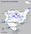 Povodí a říční síť řeky Dědiny.png 1,020 × 1,120; 47 KB
-
 Povodí Labe Vltavy Moravy.PNG 623 × 361; 42 KB
-
 RíosDeLaRepúblicaCheca.svg 1,949 × 1,200; 4.17 MB
-
 Vítáme Vás v Havlíčkově Brodě.JPG 3,264 × 2,448; 3.78 MB
-
 Wondreb Eger catchment.png 1,684 × 1,406; 1.8 MB
-
 Úpa (rivière).png 640 × 832; 745 KB
-
 Říční síť Brslenky - Římovický potok.png 700 × 900; 31 KB
-
 Říční síť Brslenky.png 700 × 900; 42 KB
-
 Říční síť Doubravy.png 704 × 811; 43 KB
-
 Říční síť Hostačovky - Doubravka.png 380 × 447; 15 KB
-
 Říční síť Hostačovky.png 380 × 447; 14 KB
-
 Říční síť Klejnárky - Chlumský potok.png 380 × 447; 14 KB
-
 Říční síť Klejnárky - Křenovka.png 380 × 447; 11 KB
-
 Říční síť Klejnárky - Paběnický potok.png 380 × 447; 15 KB
-
 Říční síť Klejnárky - Senetínský potok.png 380 × 447; 11 KB
-
 Říční síť Klejnárky - Vranidolský potok.png 380 × 447; 15 KB
-
 Říční síť Klejnárky - Vrchlice.png 380 × 447; 13 KB
-
 Říční síť Lužničky - Lesenský potok.png 650 × 765; 34 KB
-
 Říční síť Vlašimské Blanice - Chotýšanka.png 380 × 447; 13 KB
-
 Říční síť Vlašimské Blanice - Slupský potok.png 380 × 447; 12 KB
-
 Říční síť Vlašimské Blanice.png 380 × 447; 12 KB
-
 Říční síť Šlapanky - Mlýnský potok.png 380 × 447; 13 KB
-
 Říční síť Šlapanky - Ochozský potok.png 380 × 447; 13 KB
-
 Říční síť Šlapanky - Zhořský potok.png 380 × 447; 13 KB
-
 Říční síť Šlapanky - Zlatý potok.png 380 × 447; 14 KB
-
 Říční síť Šlapanky - Ždírecký potok.png 380 × 447; 14 KB
-
 Říční síť Šlapanky.png 380 × 447; 13 KB
-
 Říční síť Želivky - Barborka.png 380 × 447; 15 KB
-
 Říční síť Želivky - Blažejovický potok.png 380 × 447; 19 KB
-
 Říční síť Želivky - Bořetický potok.png 380 × 447; 16 KB
-
 Říční síť Želivky - Cerekvický potok.png 380 × 447; 14 KB
-
 Říční síť Želivky - Jankovský potok.png 380 × 447; 14 KB
-
 Říční síť Želivky - Kejtovský potok.png 380 × 447; 15 KB
-
 Říční síť Želivky - Martinický potok.png 380 × 447; 15 KB
-
 Říční síť Želivky - Sedlický potok.png 380 × 447; 14 KB
-
 Říční síť Želivky - Trnava.jpg 380 × 447; 52 KB
-
 Říční síť Želivky - Trnava.png 380 × 447; 27 KB
-
 Říční síť Želivky.png 380 × 447; 15 KB
-
 Říční síť Želivky.jpg 380 × 447; 52 KB


.png)

.png)


.png)


